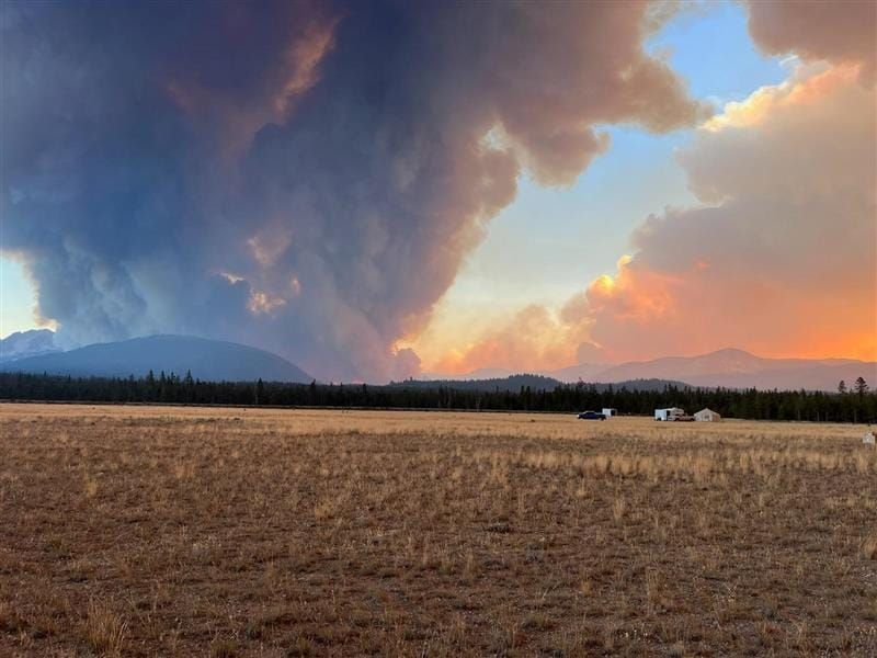
Wapiti Airshow, Snag, Nellie - 8/26
Today's update
Fires were much less active over the weekend, so I decided to use that time to get some fresh air and recover from a crazy couple of weeks at home, work, and on the fire front.
In today's update, we will examine the Snag, Nellie, and Wapiti fires–in that order since that's how my brain is currently working. I probably won't do an update on the Nellie or Snag again for a few days, unless something changes. But I expect the Wapiti will need an update tomorrow or Wednesday.
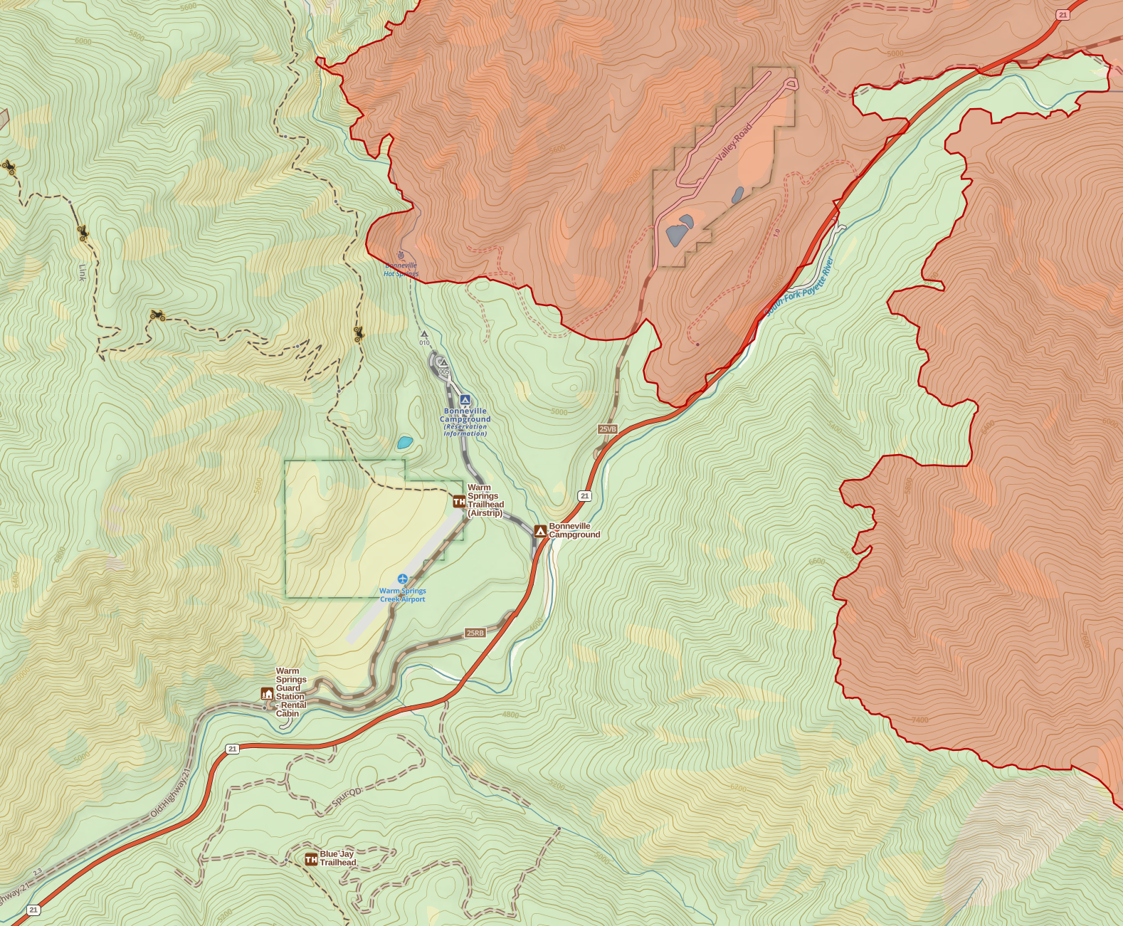
Snag Fire
25,235 Acres
3% Contained
Snag Overview
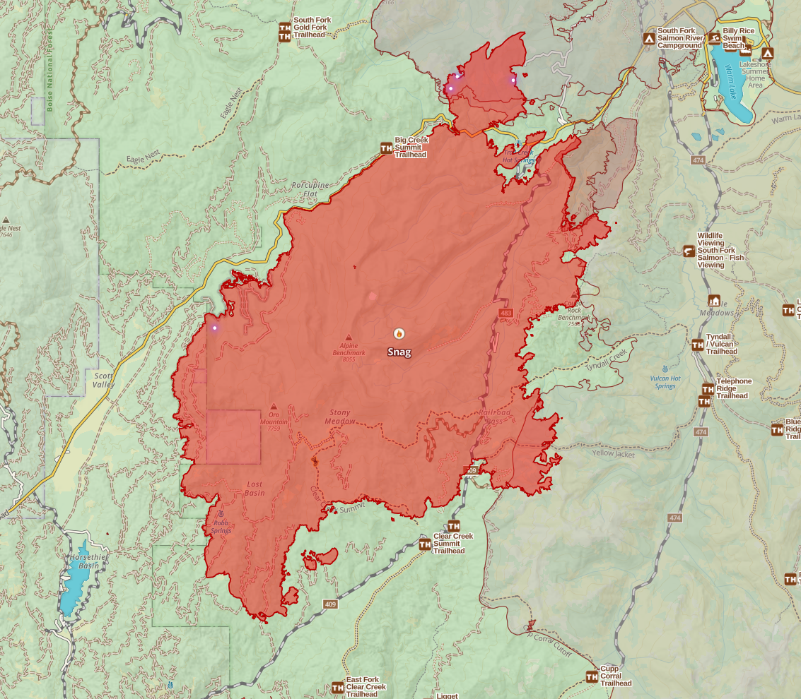
The vast majority of heat on this fire is in the northwest corner, along Warm Lake Road, both on the south side of the road and the portion that crossed the road to the north. Heat is still scattered throughout the rest of the fire, but satellite fire detections have been sparse over the last three days. This fire is by no means done, but the fire lines and cooler weather have knocked it down quite a bit.
Fire crews are planning strategic firing operations (aka burnouts) to help reinforce fire lines and increase containment.
Operations
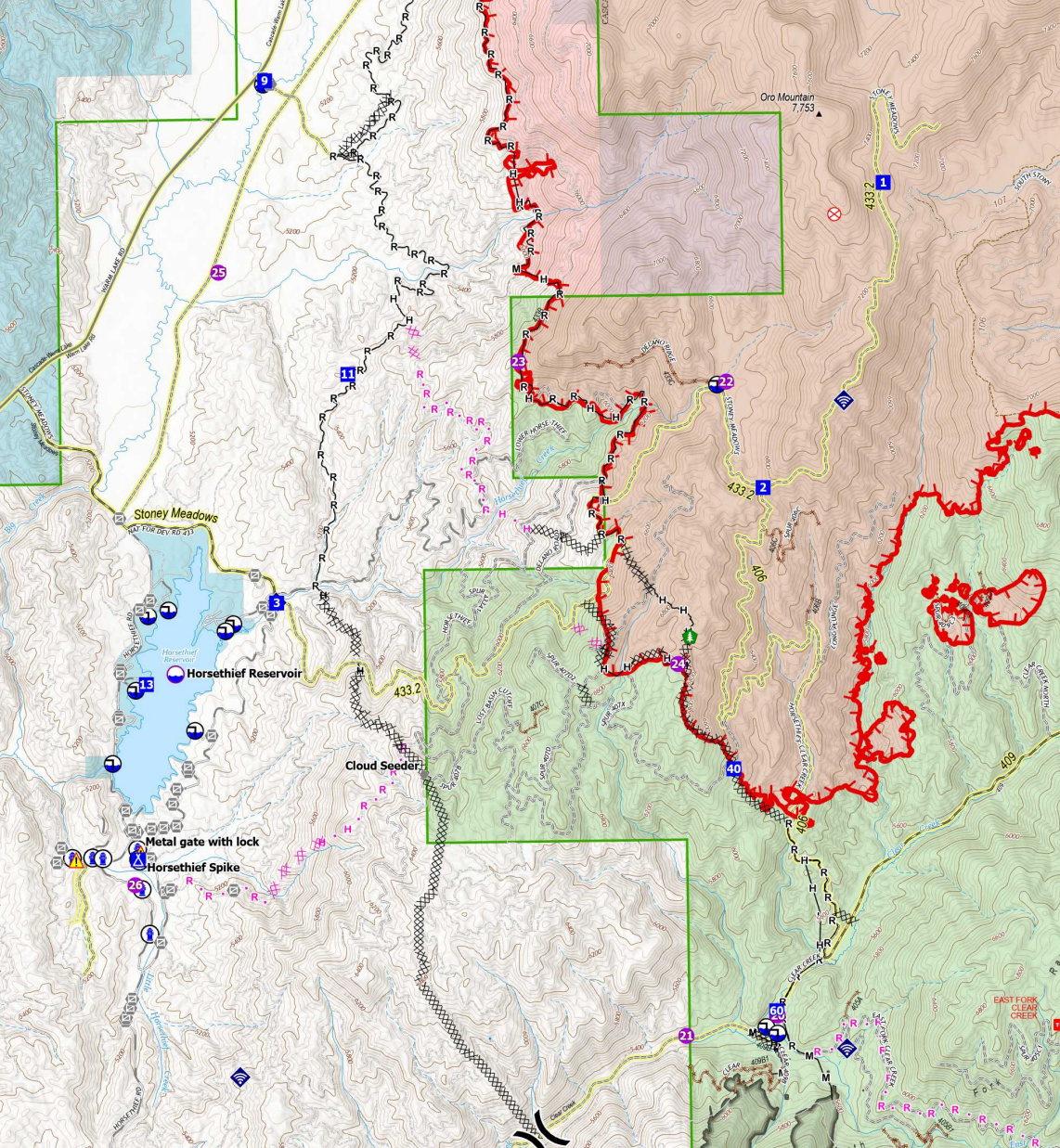
Starting on the Southwest side of the fire near Horsethief, the fire has been held at the primary line aside from one slop over they had almost a week ago. They've got that area pretty much wrapped in a dozer line at this point; I'm not too worried about it. I would be very surprised if this fire crosses this primary containment line with current and near-term predicted conditions. And, of course, they have a contingency line closer to the reservoir.
On the Southeast side, along Clear Creek Road, I don't think holding that road is a priority right now, given the limited resources, but it may naturally pin the fire in on the west end, given the behavior we're seeing right now. If the fire does run south, it'll be corralled by the 2023 East fire and the 2007 Monumental Fire Scar.
On the East side, no significant movement as the fire has burned into the 2007 Monumental fire scar. I can't imagine any further movement here.
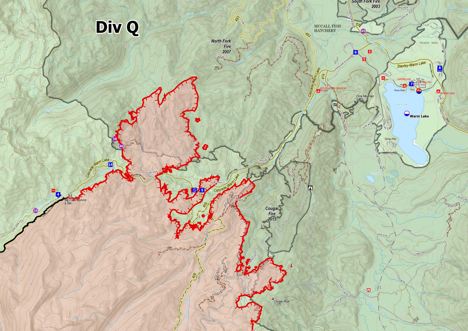
As I said before, most of the activity has been in the Northeast corner of the fire, especially in an area that crossed the Warm Lake Road. I'm not sure how much growth we'll see in that area to the north of the road, it quickly entered the 2007 Monumental Fire Scar. It's in an area of the Monumental that was less scorched earth than others, so there is fuel to burn, but significantly less than outside that burn scar. There are also a few islands and pockets of fuel that weren't burned in the Monumental. I think there is some threat of movement toward Warm Lake from this area, but I would say the risk of it reaching the Warm Lake area is relatively low. And, if it did, there are enough anchor points that I would think a burnout would successfully stop the fire before any structures or resources in the area were at significant risk.
On the Northwest side, along Warm Lake Road, moving towards Horsethief, I think this fire is looking good, and we're starting to see actual containment achieved on this side. One small area along the warm lake road isn't shown as completely lined, though the fire stops at an old logging road marked as a proposed line. Either they haven't finished improving that section of road or haven't logged it as done. I think this may be one of the areas they're talking about doing a burnout today. I could be wrong about that, though; regardless, I'd expect that spot to be lined in the next day or two.
Snag Wrap-up
I'm not concerned about the Snag Fire impacting Horsethief or Warm Lake at this point. The threat could change if we get a few hot dry days and high winds and have a string of bad luck--there's a reason you don't call fireline contained until it meets a high bar. But I'm seeing a lot of lines that, while it doesn't meet that contained definition, it really should hold at this point.
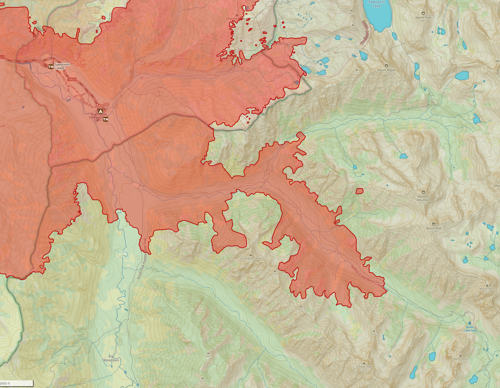
Nellie Fire
40,006 Acres
5% Contained
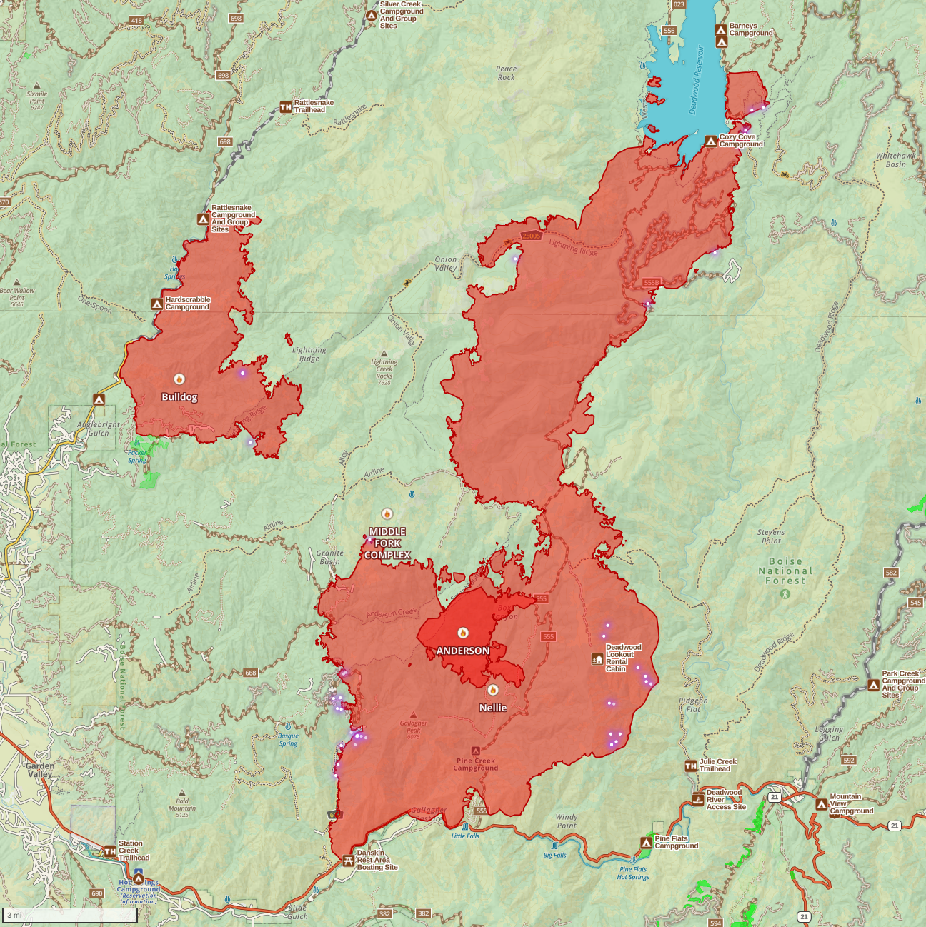
Nellie Overview
Like most of the fires in central and west-central Idaho, the Nellie has shown decreased activity over the last few days due to the cold front bringing cooler, more humid conditions. At this point, the forecast looks to be warmer and dryer, though not as hot as we were seeing before the cold front, but more typical of late summer.
There are three main areas of concern on this fire: the first is at Deadwood Reservoir, the second is on the southeast side near Loman, and the third is on the southwest side near Garden Valley. Pretty much everything else is pinned in due to historical fire activity.
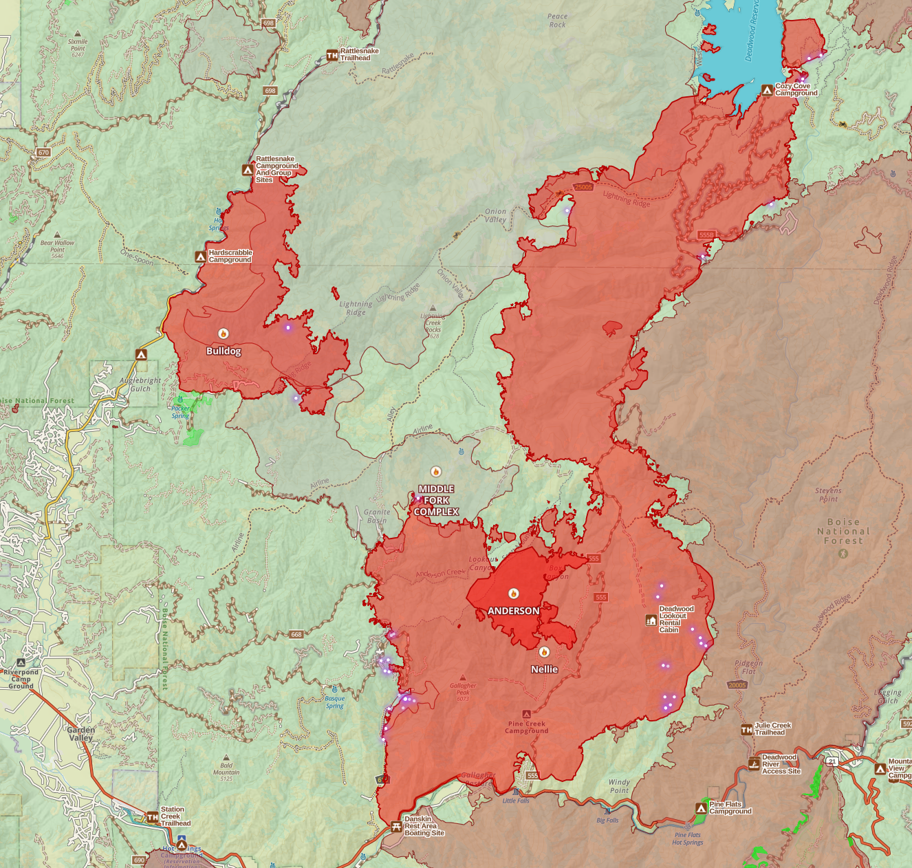
Compared to the overview map I posted at the top, in this map I've added in the last 20 years of historical fire activity. If you've been following my newsletter for a few weeks, you'll likely remember me saying that this fire would be corralled by the 2017 Pioneer and the 2006 Rattlesnake complex fire scars, especially as it moved north toward Deadwood. You can see in this map that Nellie has done just that, hugging the Pioneer on the east and being pushed east by the Rattlesnake.
Nellie Operations
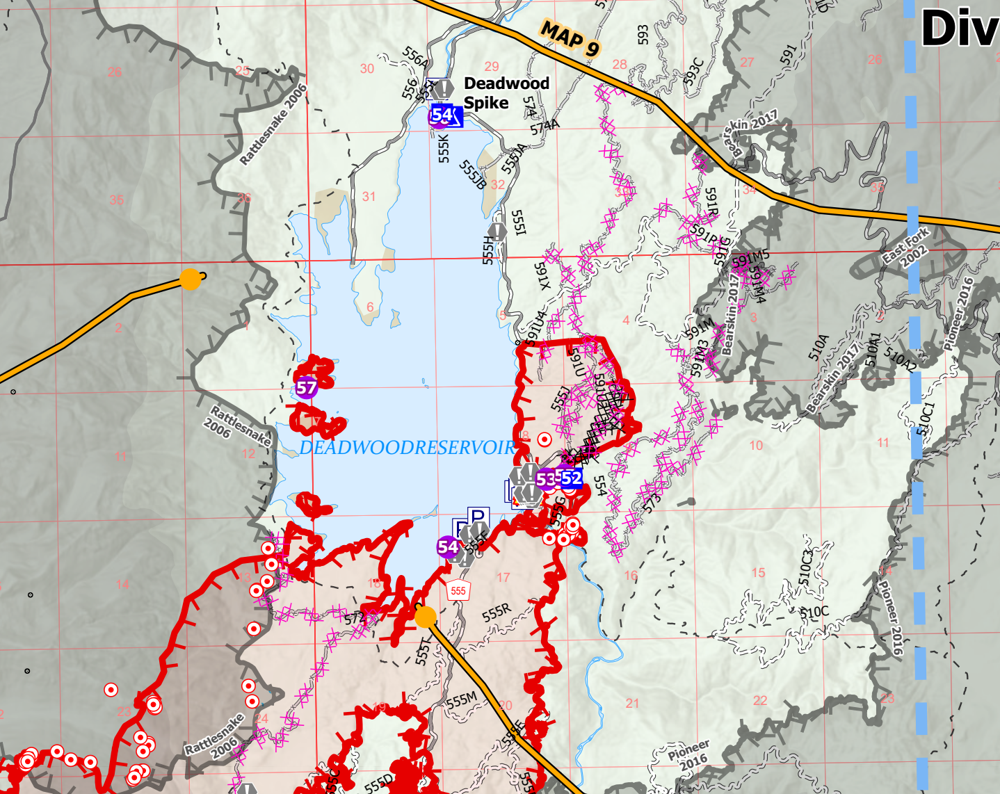
Starting at the north end, around Deadwood crews are now trying to prevent northern progression of the fire beyond deadwood. They're using some old roads and dozer work to tie a line between the lake and the 2016 Pioneer Scar. That's a pretty small chunk of forest they need to wall off between the lake and the old burn, I'm fairly optimistic it'll be a success.
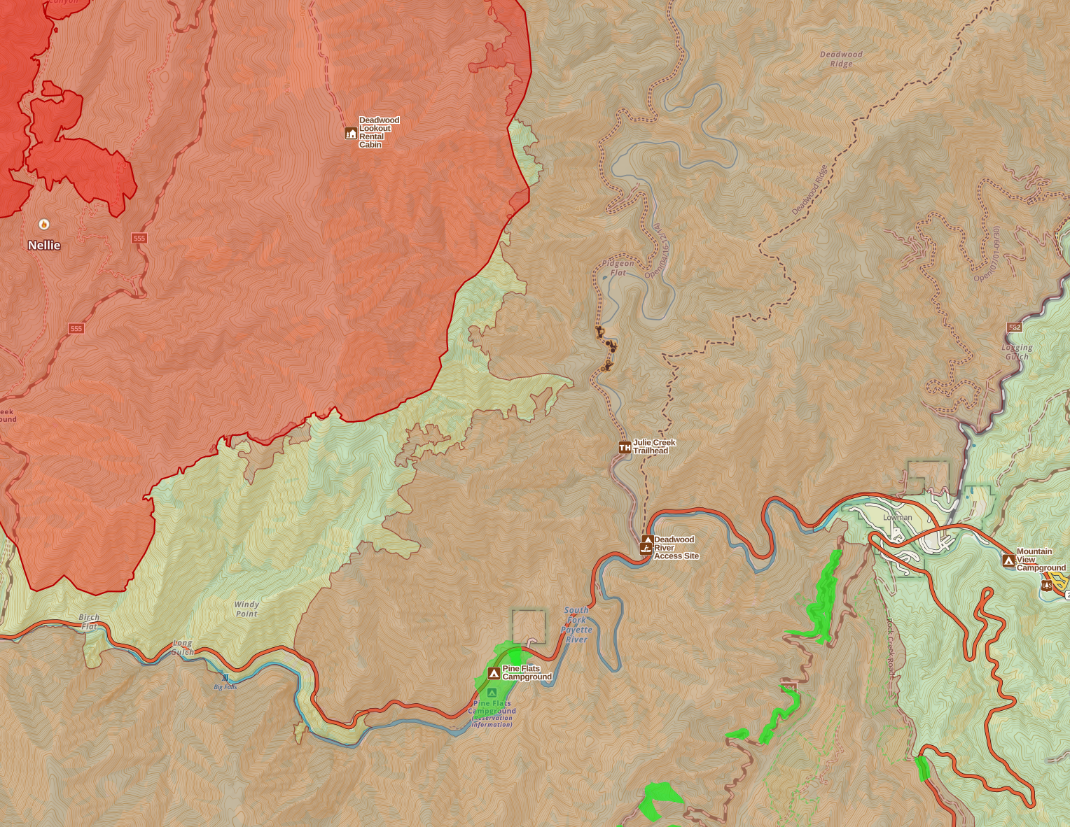
Moving to the southeast side of the fire, the fire has reached the 2017 Pioneer, and it doesn't seem motivated to move into it. There are pockets of fuel in there that it could get into and be a problem for Lowman, but I don't see it as a significant concern in our current weather pattern. If there is more movement here, they'll work on it, but otherwise, it's a low priority at the moment.
Alright, now for the Southwest side. If you've been following my commentary on this fire, you'll recall a week or two ago I mentioned this fire being a long-term threat. I think I also mentioned that it should be somewhat easy to stop progression in that direction, so I wasn't hugely worried about it, but noted it as an expectation. The fire has indeed moved that direction, most of that movement was on the last two days of extreme heat that we had before the cold front. But unchecked, it'd still burn that way.
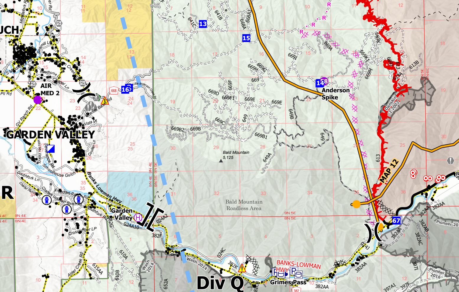
From what I see on the operations map and from what I see in updates, I think they'll have this side butted up pretty quickly. At the road, the fire is at a Management Action Point that would likely spur evacuation "READY" status for much of Garden Valley. But I'm inclined to believe that won't happen at this point. While structure protection assessment and planning is ongoing in Garden Valley, I don't currently think the fire will get established on the west side of that line. As I understand it, the proposed dozer line (pink-ish XX marked line) is largely cut and fire crews will be working to improve it and at some point soon do burnouts to tie it into the fire.
Nellie Wrap-up
I think fire crews are doing a good job with this one and are making significant progress toward protecting the Banks-Lowman corridor and the Garden Valley / Crouch area. There's still a threat, but I like what I see. While the weather does warm up and dry out over the next few days, it'll be nothing like what we had before the cold front. I expect good progress will be made in the next 48 hours.
Wapiti Fire
68,124 Acres
Overview
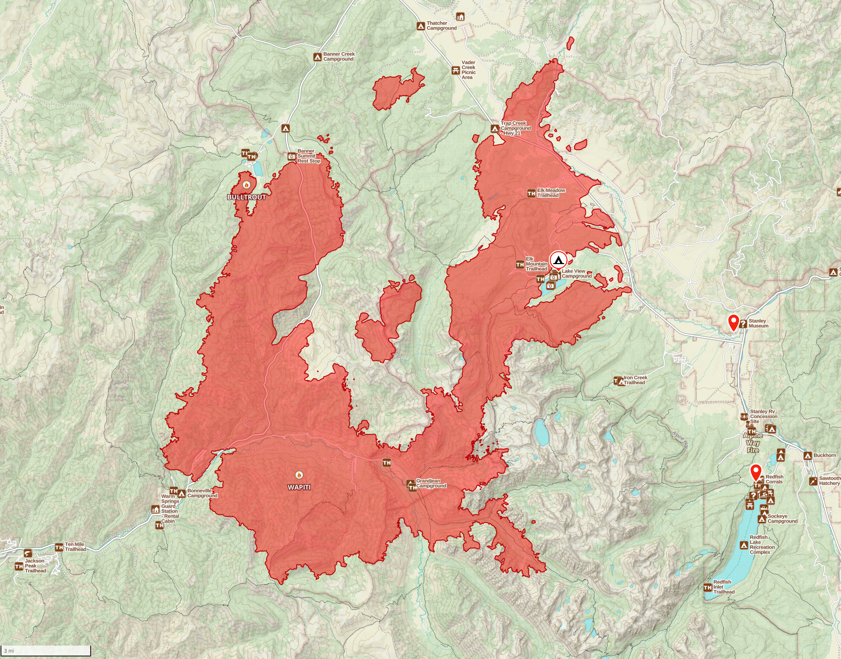
The weekend was a much-needed breather for the Wapiti fire. It didn't grow much at all, and the overall activity was very moderate due to cooler weather, higher humidity, and cloud shading. Highway 21 is still closed Stanley to Lowman, and will be for the foreseeable future. Most resources are focused on protecting the town of Stanley and the small communities (e.g., Goat Falls, Iron Creek, Crooked Creek) on the outskirts of town. These communities are under an evacuation order as the fire is approaching from the Northwest.
Forecasted weather over the next few days is warmer, dryer, and sunnier, and include winds out of the Northwest. A northwest wind on this fire right now would be catastrophic. Which is why we're seeing the events this evening (more on that at the end).
In the interest of getting through this before everything changes, I have a few bullet points around the fire and a gallery with a few detailed maps below. Then, I'll focus on the Stanley Basin and the firing operation in Stanley tonight. (monitoring that is why it's taking me so long to get this posted today)
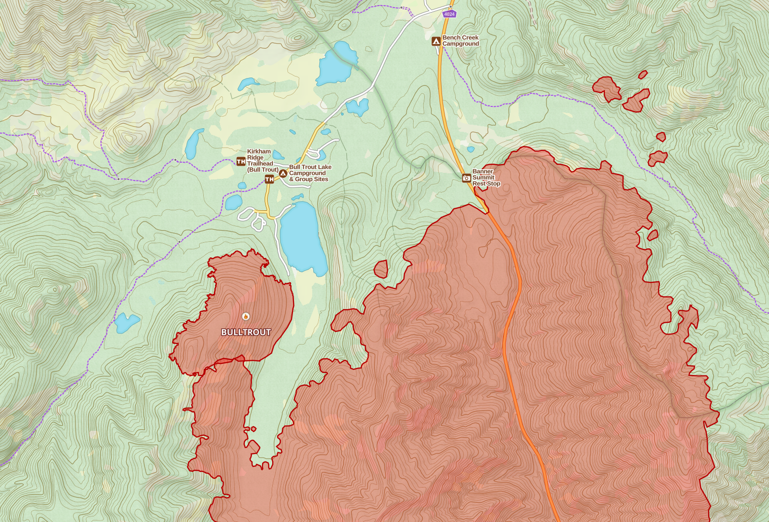
- The fire has consumed the Bulltrout fire at Bull trout lake.
- The fire has reached Banner Summit.
- There is activity in the Warm Springs area, it remains a big concern.
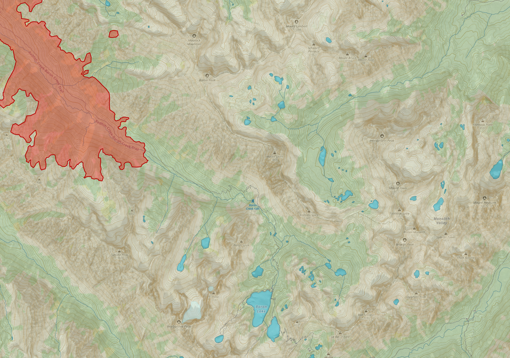
- Fire has been moving up Barron Creek, a concern I've had from day one. Northwest winds are predicted in the next few days, this would align with the terrain and I'm very concerned that the fire could move out of the Barron Creek canyon into Fishhook Creek, or Redfish Lake Creek.
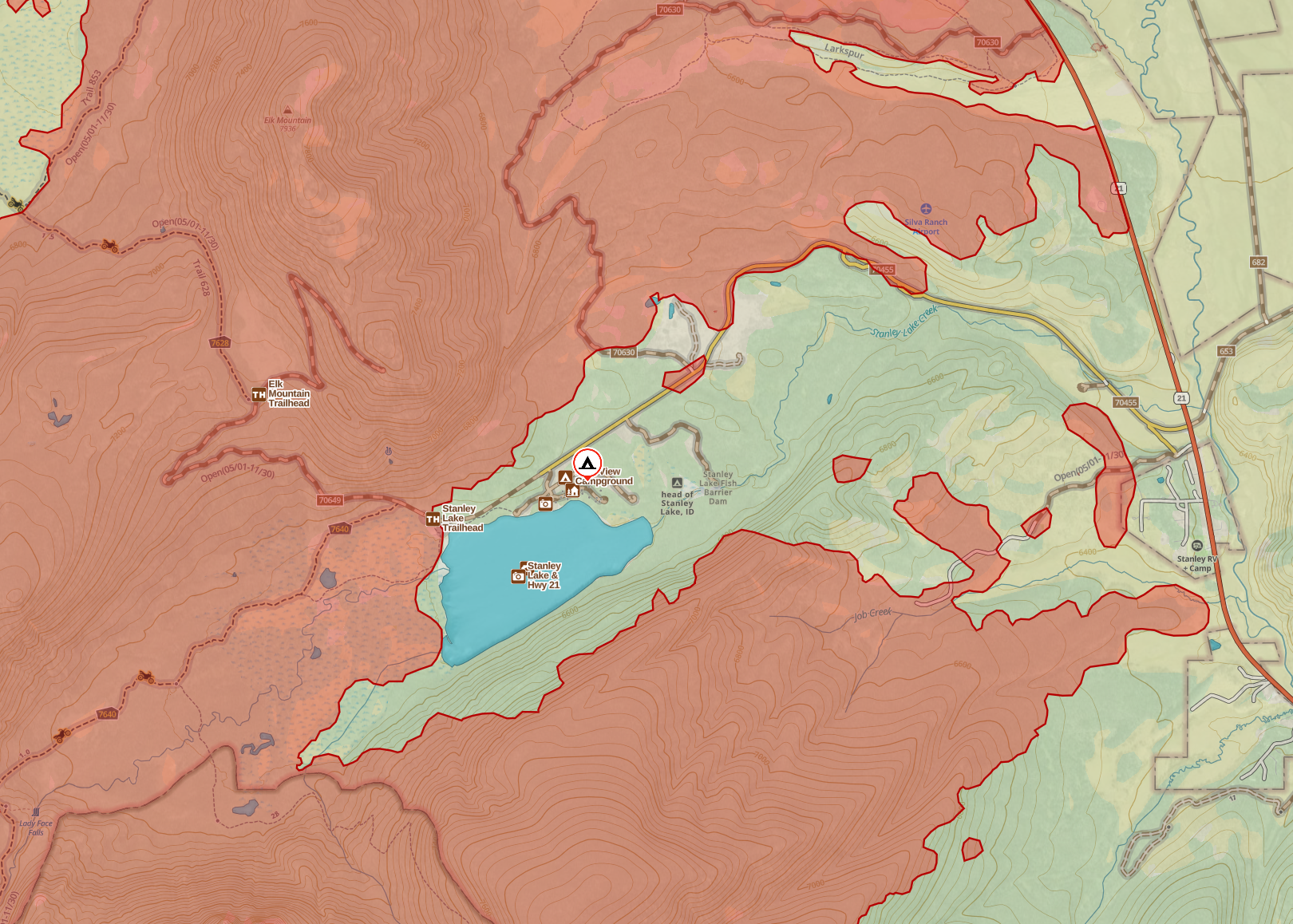
- Stanley Lake Campground hasn't burned. Given winds and weather predicted, 50/50 chance it does. Though I'm somewhat hopefull they'll have resources to protect it if it hasn't burned in the next 24 hours or so.
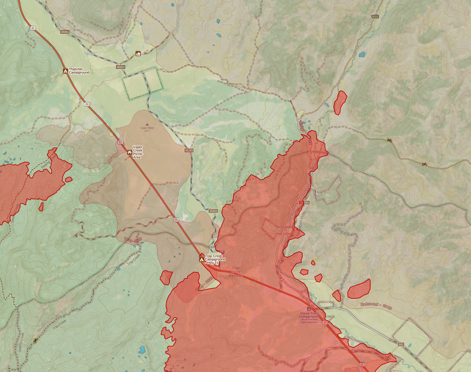
- A Spot fire, which is now way to big to call a spot fire, is burning in the Cape Horn area in Swamp Creek. This has room to grow and won't be attacked in the foreseeable future due to other priorities. It's just gonna burn whatever it wants to in Swamp Creek. I don't think it'll cross 21, might not reach it given rcent fire history in the area.
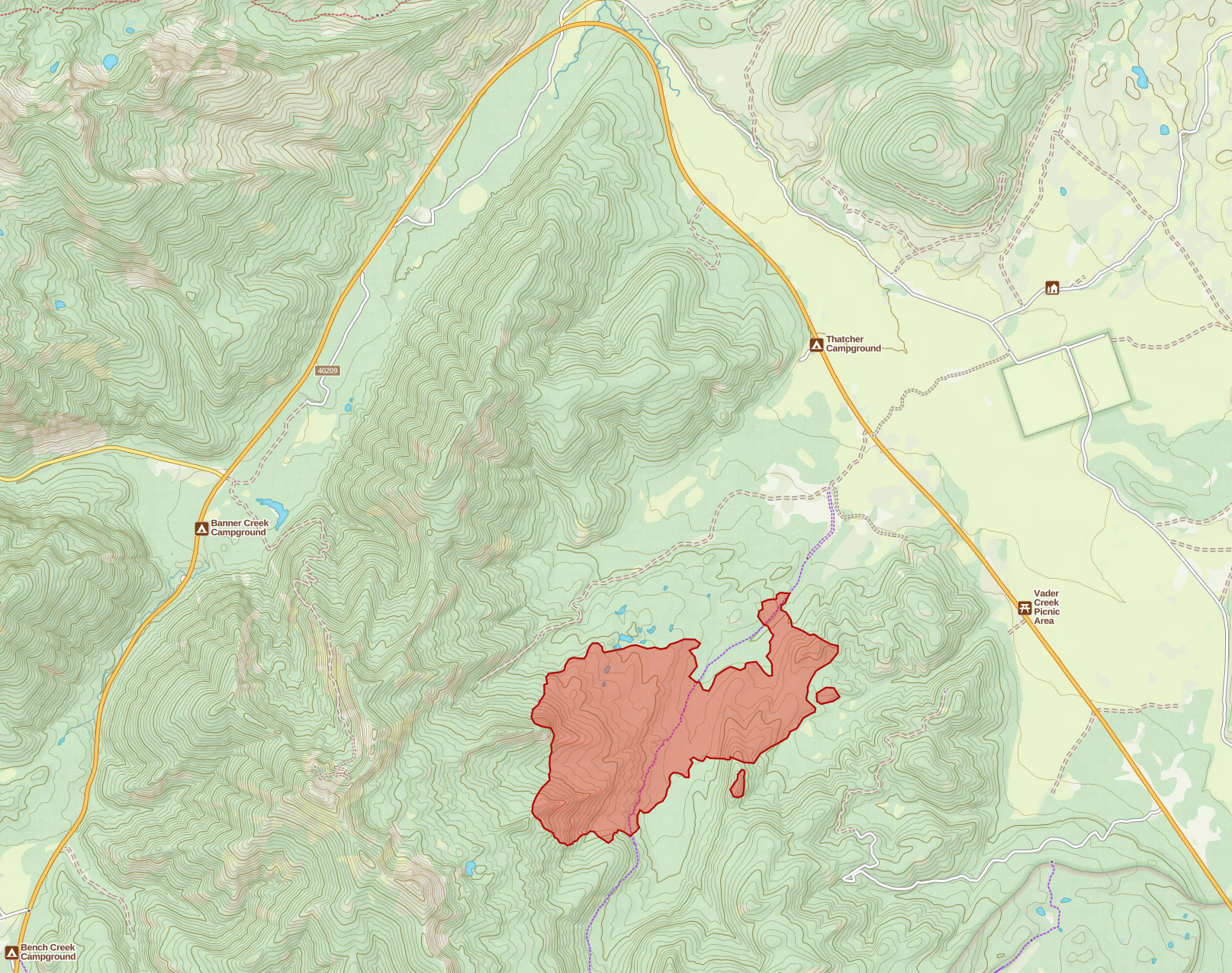
Selected Map Detail From the Wapiti Fire - maps by me
Stanley
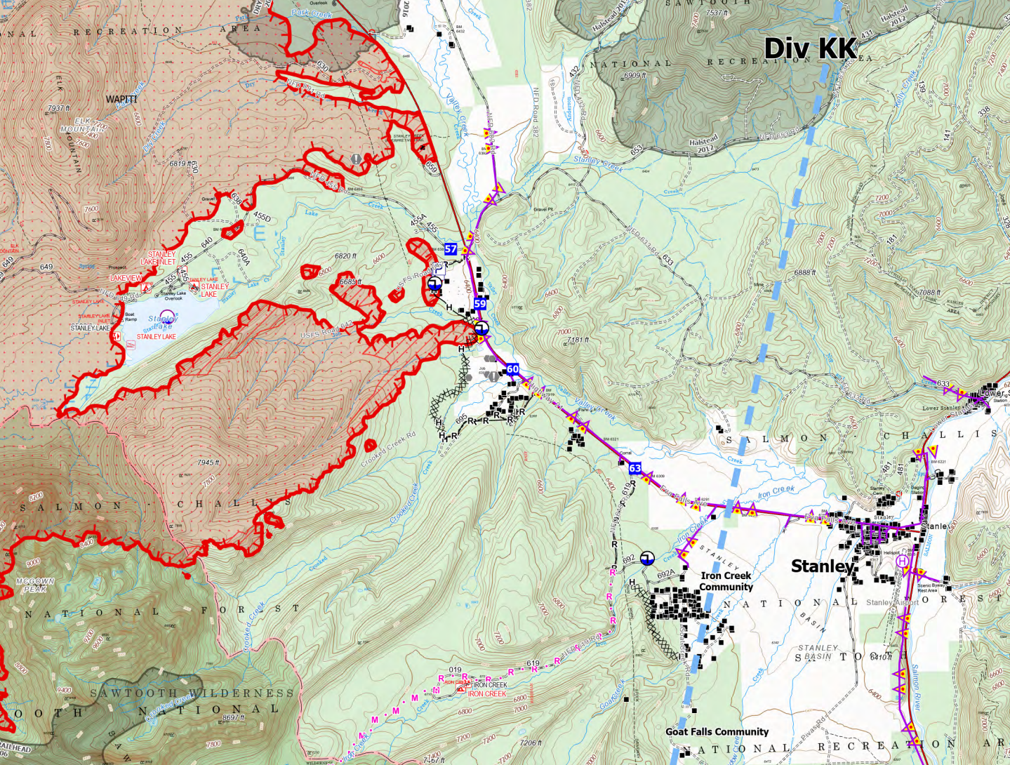
With those updates out of the way, let's talk about Stanley. Here's a detailed map to start us off.
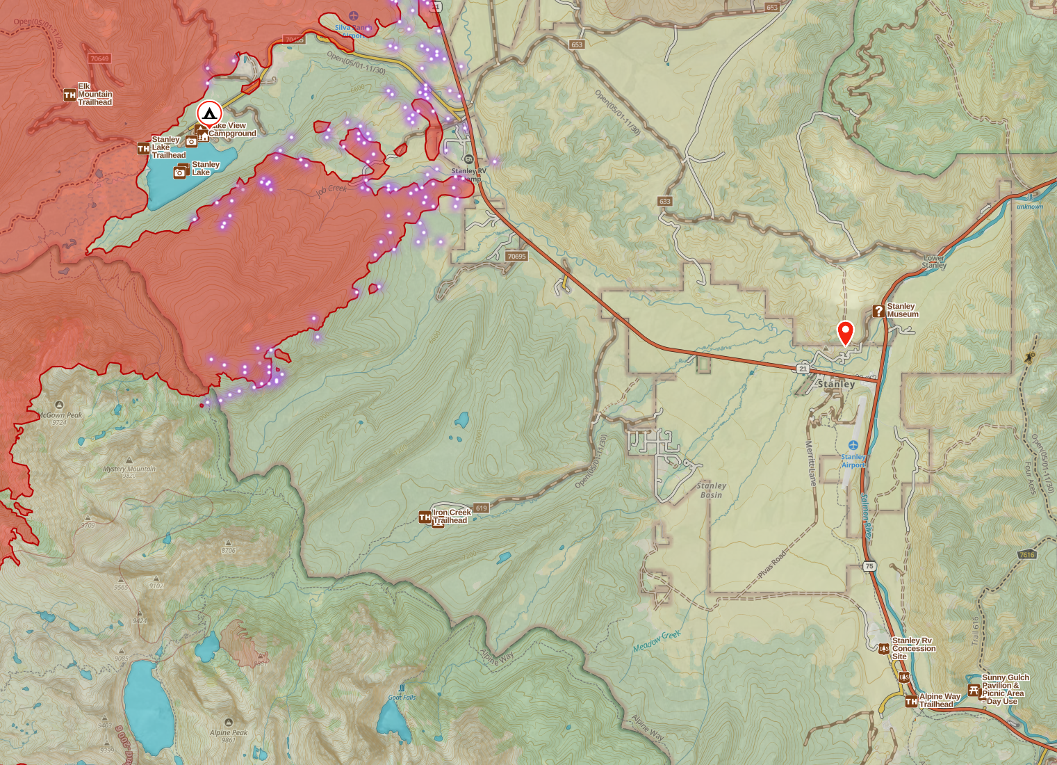
As I mentioned above, northwest winds are predicted to hit midweek. As you can see, the fire is northwest of Stanley, and it's burning along the front of the Sawtooth Mountains, in effect, a wind from the northwest would not only push the fire toward Stanley, but that wind would be funneled down the valley and accelerate along the face of the Sawtooth. This would be a worst-case scenario. The timber in between Stanley Lake and Stanley is thick and nasty, with tons of standing and down dead beetle kill, and just super thick overall. A fire in that with a warm wind behind it would run like crazy and could very easily burn everything in the Crooked Creek, Iron Creek, and Goat Falls communities.
Air show
Earlier today, and the main reason I'm late getting this post out, Fire Managers alerted the public that firing operations would commence in the Iron Creek area in effort to protect the town of Stanely. It was mentioned that this effort would be supported by Very Large Air Tankers (VLATs).
Over the past few hours I've been sitting here, virtually watching the air show and I'm quite impressed. I've been working in or following Wildland Fire in Idaho for damn near 30 years (27 or 28, I think); I've worked some of the most infamous fires in Idaho and followed basically every fire in Central Idaho since.
In all that time, I can't remember an Airshow that rivaled what we're seeing tonight in Stanley. Here's the response that I've noticed.
- Two DC-10 VLATs (Tanker 911, Tanker 912) on load and return out of Pocatello (Pocatello and Boise are the only two VLAT-capable bases in Idaho).
- Two BAE146 Large Air Tankers (LATs) respond out of Cedar City, Utah, load and return out of Boise.
- A Boeing 737 out of Helena, Montana. Load and Return Boise.
- Another LAT (don't remember type) out of Missoula, Montana, load and return Boise.
- Two RJ85 LATs, Boise.
- 1 or 2 C-130 LATs Boise.
- And probably others I'm missing.
So, what exactly are they doing?
As the mid-day update stated, these tankers are supporting a firing operation. There are various ways this could go, but from my understanding in this case they're painting the fireline, then crews are going in and using that line to anchor a burnout. Generally, you'd anchor a burnout to a hand-built fireline, a dozer line, a road or some natural or existing anchor point. By burning the material out between that line and the fire, you remove fuel and create "black", the more black between you and the fire the better.
In this case, it sounds like they needed this airshow to paint a retardant line such that they could anchor off of it for their burnout. And, if you need to paint a long retardant line quickly, you want a VLAT. Or in this case two, on load an return. And a bunch of LATs. Seriously y'all, the amount of retardant falling out of the sky near Stanley this evening is insane.
Tonight is going to be a big night on the firelines as sunsets and into the wee hours, there's going to be a lot of active fire. You may even see Drones/UAS work doing aerial ignition overnight. I'm not sure how wide of a black buffer they want here, but I'd want it BIG. This effort really is an effort to protect Stanley.
I expect I'll need to do an update on the Wapiti tomorrow, so I think I'll end it here and keep watching the Air Show. If you're in Stanley tomorrow, hug a Hot Shot.
Member discussion