Quick updates on Wapiti, Nellie
My apologies; today's update will be shorter than I wish I had time for. There's a lot to dig into, but today's (and tomorrow's) work schedule, coupled with today being the first day of 5th grade for the kiddo – I just don't have time for a really deep dive. But here are two quick updates.
Overview
Yesterday was an active day for the Nellie and Wapiti fires, a bit less so for the Flat and relatively moderate for everything else. The Snag fire, of particular interest to many folks reading this, is looking pretty good, considering the weather we've had in the last 48 hours. But generally, there are no significant changes to my recent analysis of any fires other than Wapiti and Nellie, which I'll cover below.
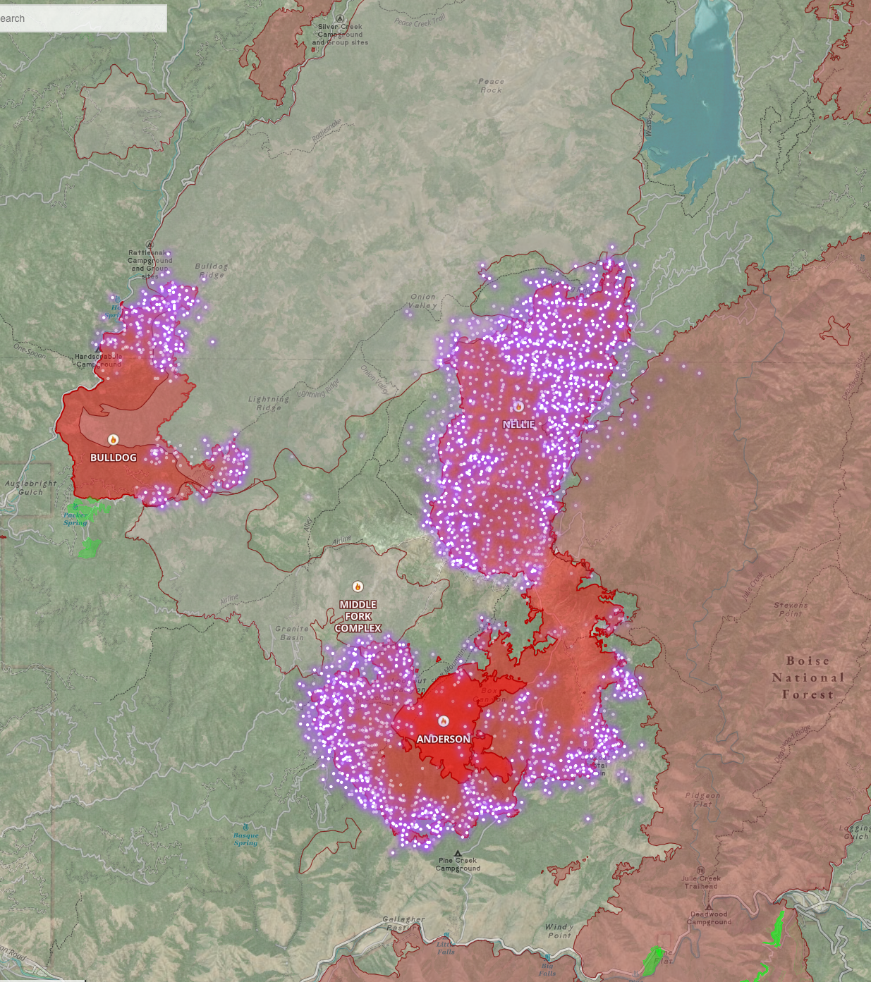
Nellie Fire
Here are two quick maps of the Nellie fire. The first is a 2D look at the fire, basically the same map as the last one I posted. You can see the fire made quite a run north towards Deadwood.
The second is a 3D map showing proximity to the Banks-Lowman road (county road 17)
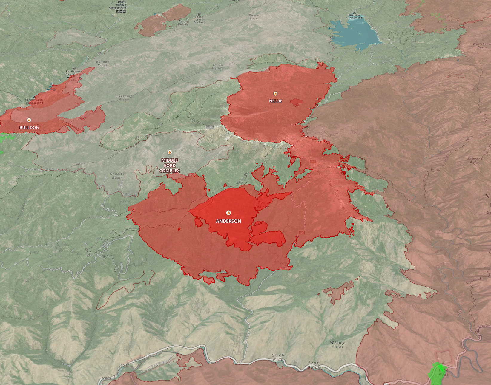
As a reminder, ignore the "Anderson" Fire on these as the Nellie overtook it.
If you read my last commentary on the Nellie, nothing has changed about my long-term thoughts on this fire. The fire is doing exactly what I said it'd do. The significant event here is that the run to the north extended even further, and the fire quickly approached deadwood. But if you look at the run, you can see it's burning within the area between the historical Rattlesnake complex and Pioneer fire perimeters as I thought it would. I don't believe the fire will go far into either of these, especially not the Rattlesnake.
I expect the fire to continue its northward march to Deadwood. Crews are at the reservoir doing point/structure protection. Given their resources, I'm not sure if they have a goal of holding the fire at Deadwood. There are a couple of existing anchor points where they might have a chance if the fire gives them the time. We'll get more info in the next 24 hours.
If you read my last update, you'll recall I mentioned the threat of the fire moving west towards Garden Valley and Crouch. I said I thought it was a reasonably long-term and low threat, but it is a threat. In today's operations update, they mentioned that they were putting resources in the area to evaluate that threat and make a plan to prevent the fire from moving west and impacting those communities. I was pretty happy to hear this mentioned.
Wapiti Fire
First, if you hadn't seen the news, six cabins in the Wapiti Summer Homes area were lost to the fire, which managed to cross the valley and establish itself on the north side of the river.
Yesterday was a very active day on the fire. The north flank made quite a run-up Mount Zumwalt. The fire was slowed by the 2003 Canyon Creek burn scar and the 2018 Wapiti fire area. However, the fire behavior was extreme, and there was a long-range spot fire that I measured at about 1.5 miles ahead of the main fire.
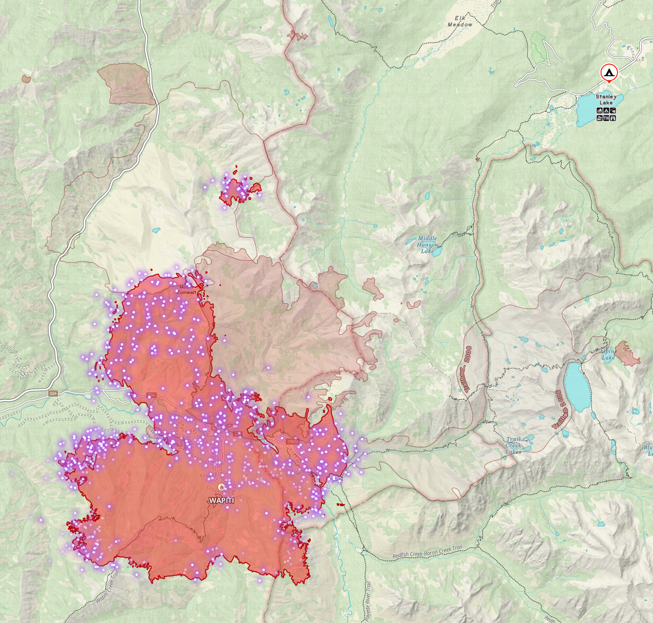
It will be very interesting to see what the behavior in the older fire areas is over the next couple of days. My main concern for this fire is Elk Creek; I'm really hoping that the fire stays on the south side of the Sawtooth and doesn't get established in Elk Creek, as fire in that drainage would likely be very intense with room to run in ways we'd rather it not.
My other concern is eastward movement into Baron Creek; with the right terrain-aligned wind, fire in Barron creek could make a substantial run. I do expect some westward movement to Highway 21, and the road may need to close at some point over the next few days. Crews are in the corridor monitoring and preparing for potential movement in that direction.
At this point, we need a weather change and a breather on this fire for a few days. Looking at the week ahead, we're going to be windy and generally unstable for much of the week. We'll be a bit cooler Wednesday then warm again ahead of a cold front approaching towards the weekend that could drop the temps and bring rain–current snow levels are predicted at 9,500' but of course that forecast is four days out and may change significantly. Unless something drastically changes, nothing in the long-range forecast will significantly decrease this fire threat, but cooler and more humid weather would give fire crews a fighting chance to catch up.
Member discussion