Cascade Area Fires - 8/13
Overview
In this evening's newsletter, we'll take a closer look at the fires around Cascade, the Flat Fire and then make short notes on a few others. As always, do reach out if you have questions about specific fires. I'm happy to help.
There are currently 64 uncontained fires active in Idaho.
Cascade Area Fires (West Mountain Complex)
Most of the fires burning around Cascade are part of the West Mountain Complex, meaning they're being managed by one Incident Management team that can prioritize and coordinate resources between the area fires and assist with any new Initial Attack fires in the immediate vicinity.
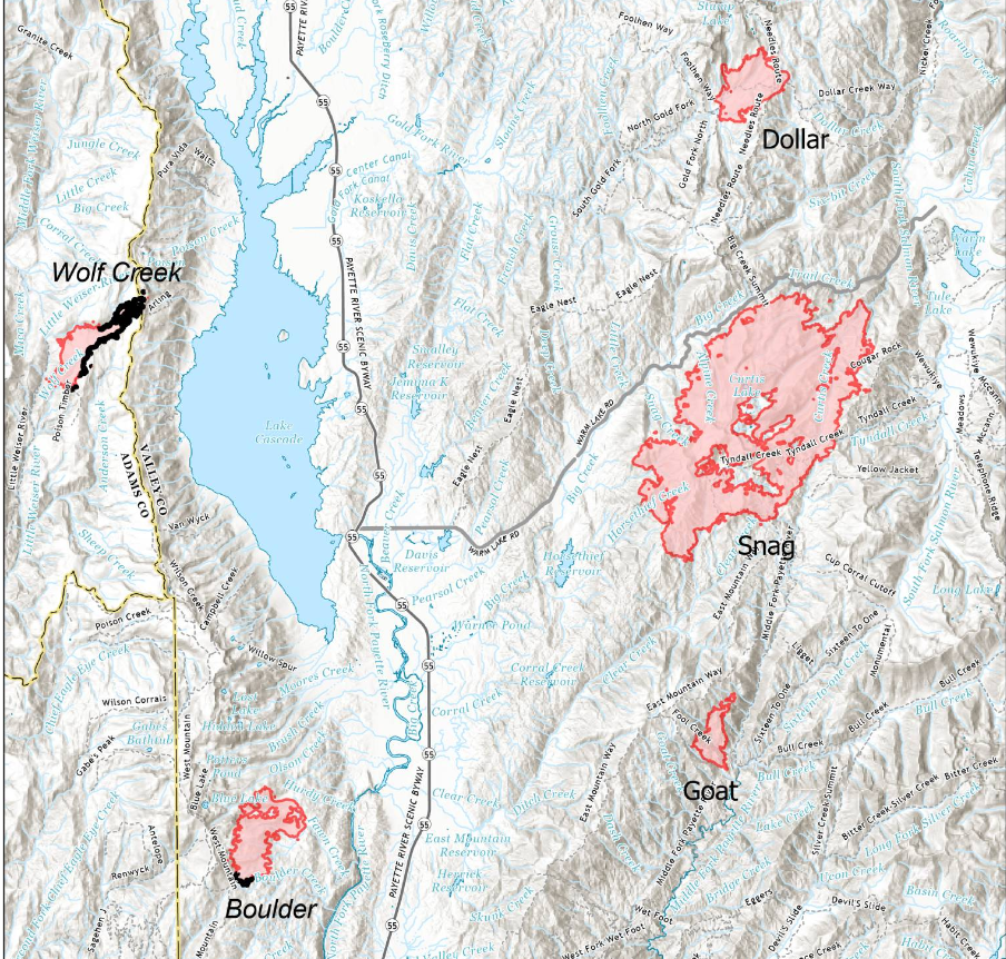
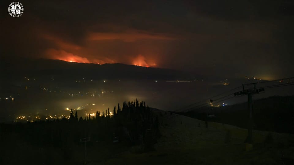
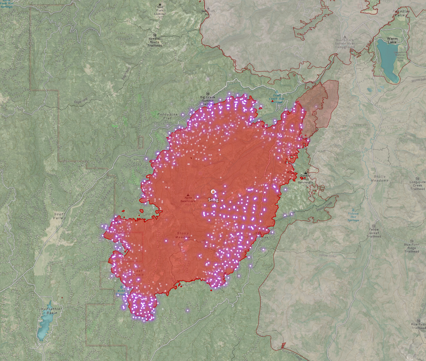
Snag Fire
17,118 Acres - 0% Contained
Been getting a lot of comments and questions on this one...
The Snag fire, burning between Horsethief and Warm Lake, will probably be nearing 20,000 acres when I write this. The vast majority of work on this fire is being done to prevent westward movement into the Horsethief Reservoir area. Existing roads and new dozer lines are being improved and prepped as primary containment lines. As the fire moves west toward these lines, it will hit management action points (trigger points), which will likely trigger two things—first, an increase in evacuation level for that area. Second, fire crews will be looking to do a burnout along those primary lines. This strategic firing operation will create a buffer of black between the line and the fire, improving the chances of those lines holding. The fire is steadily moving toward this area, but I don't have enough insight into this flank's fuel and progression rates to know when these actions may be needed. I wouldn't be surprised by tomorrow, nor would I be surprised if it's several days.
Looking at the fire's south side, I don't expect any suppression activities to prevent movement south, except those that might be associated with preventing westward moment as the fire approaches Clear Creek Road.
The East side is pretty simple; it will burn into the Monumental (2007) burn scar and lose a ton of steam. As I've said in my last several updates on this fire, point protection will be in place around structures in Warm Lake and Stolle Meadows area once the fire crosses the ridgeline. But the fire approaching those structures will be a far different beast than it is now as it loses energy in that old burn scar. It's hard to say exactly what fire behavior will look like at that point (I've spent a lot of time around fire ecologists, but I'm not one, don't pretend to be one, and it's been years since I've been to Warm Lake).
Depending on fire behavior in that burn scar, we could see various suppression methods once fire crosses that trigger point. If I had to wager money, my guess would be a mix of hand firing along the road and nighttime UAS (drone) aerial ignition to introduce a lot of low-intensity fire on that ridge. But I could see several other scenarios playing out. Regardless of how it plays out, I'm not too concerned about the Warm Lake area.
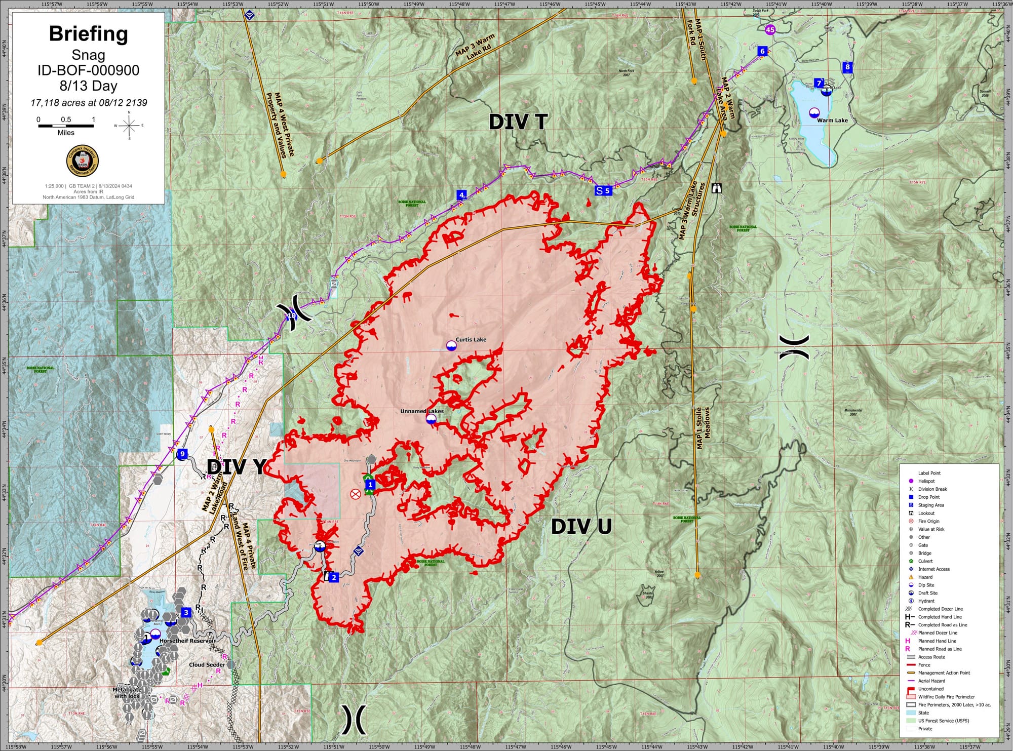
Alright, I'm moving to the Warm Lake Road (north) side of the fire. The fire is active here but backing slowly towards the road. The last official word I saw was that the fire was within a few hundred feet of the road. They've also had spotfires across the road but, so far, have handled those. Given the proximity of the Idaho Power transmission line to the fire, they've de-energized the line for firefighter safety and to help prevent the line from contributing to the fire should it be directly affected.
I'm operating under the assumption that they plan to hold the road, and given that they are discussing knocking down spot fires, it sounds like they are. But the road isn't mapped as a containment line, and all discussions of suppression efforts along the road have been in passing; I haven't seen anything in press releases or daily reports that indicate what these efforts are beyond protecting the Idaho Power transmission line. So, while I am near certain they are planning to hold the road and generally think they'll be successful, I'm not seeing details, so I don't have anything specific to share. To be clear, I'm not saying they aren't holding the road; I'm saying I can't find more info about their plans/actions here.
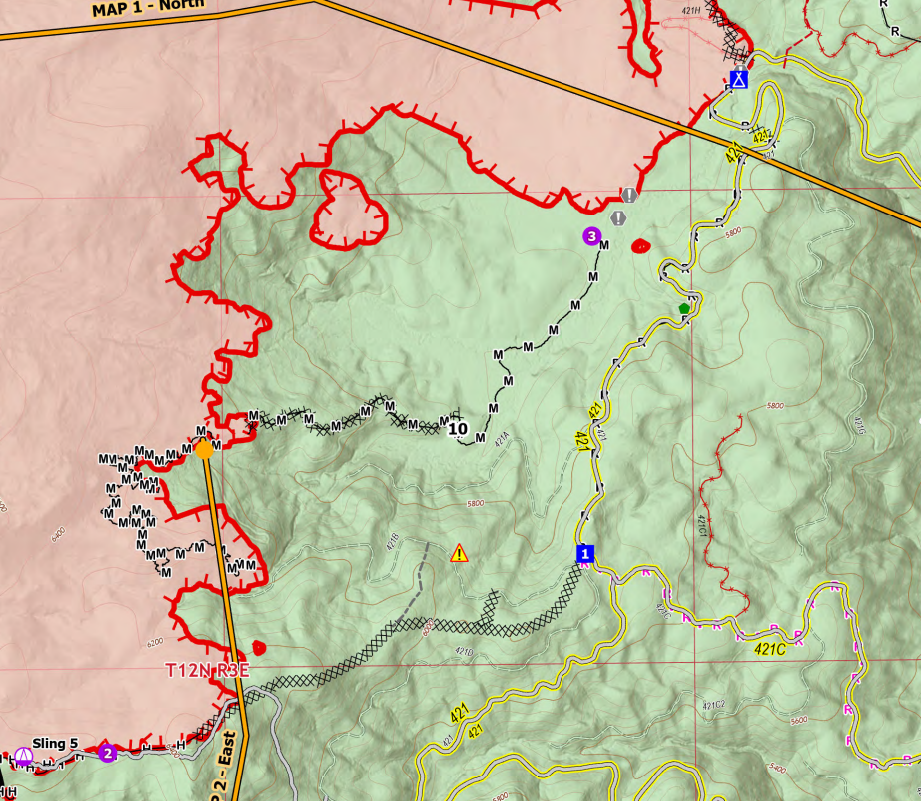
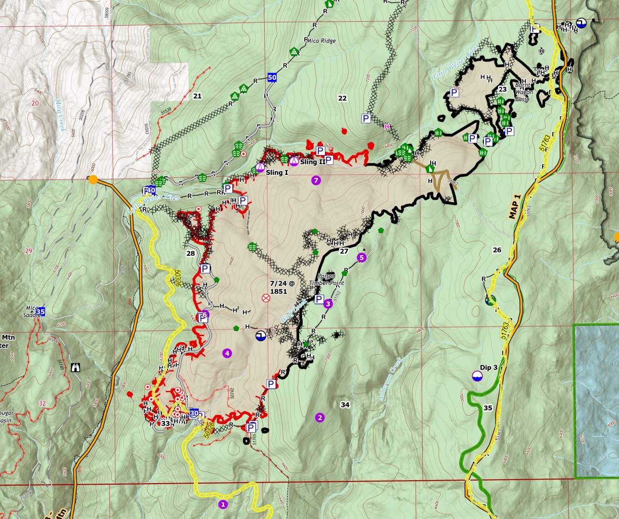
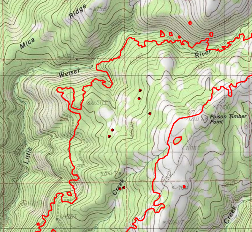
Boulder Fire
1,908 Acres - 7% Contained
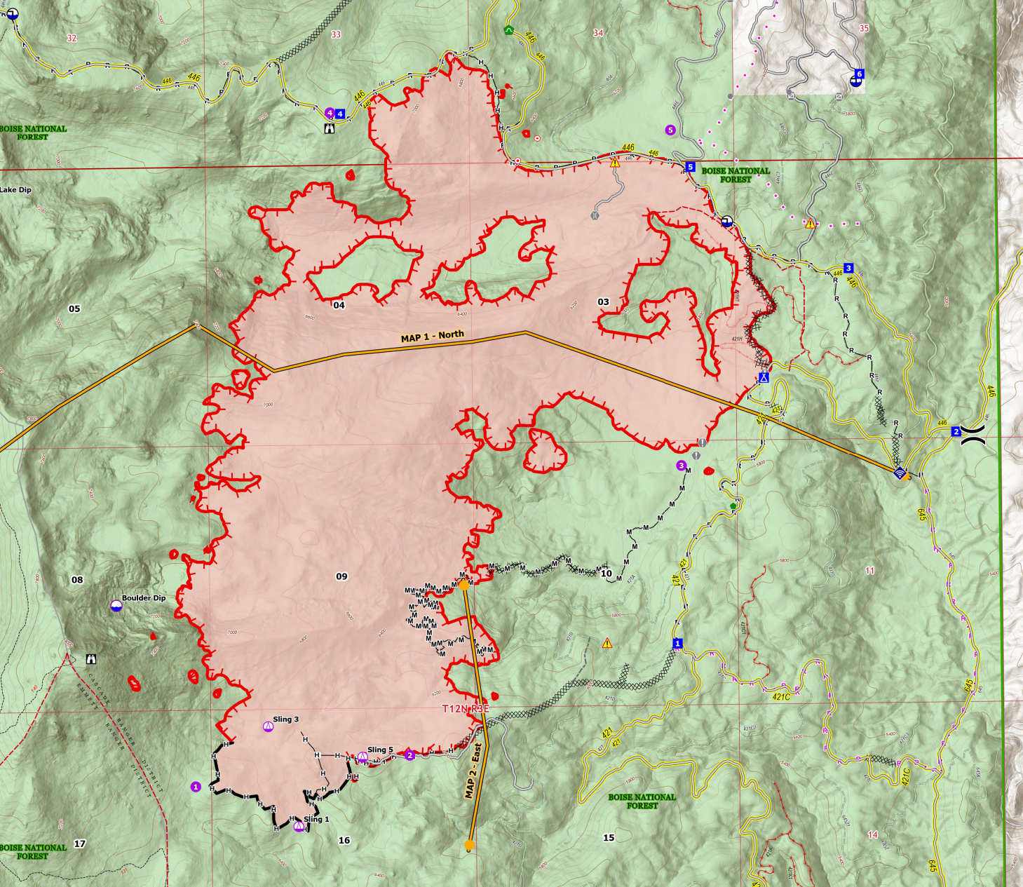
The Boulder fire is still very much active, and containment is only 7%, but looking at the details, this fire is looking really good. It is a full suppression fire, with a mix of direct, indirect, and contingency lines in place. Over the past week or so, fire crews have been conducting fairly substantial firing operations, burning out their dozer and handlines to establish a sizable perimeter of "Black" as a fuel break. Given the fuel load in the Fawn Creek area, I think this strategy was a great call; it appears to have been planned and executed very well. Crews will continue reinforcing containment lines with strategic firing operations on the north and east sides of the fire. The south side of the fire still has some remaining heat (IR Image below), but that end of the fire should be in a pretty good state at this point.
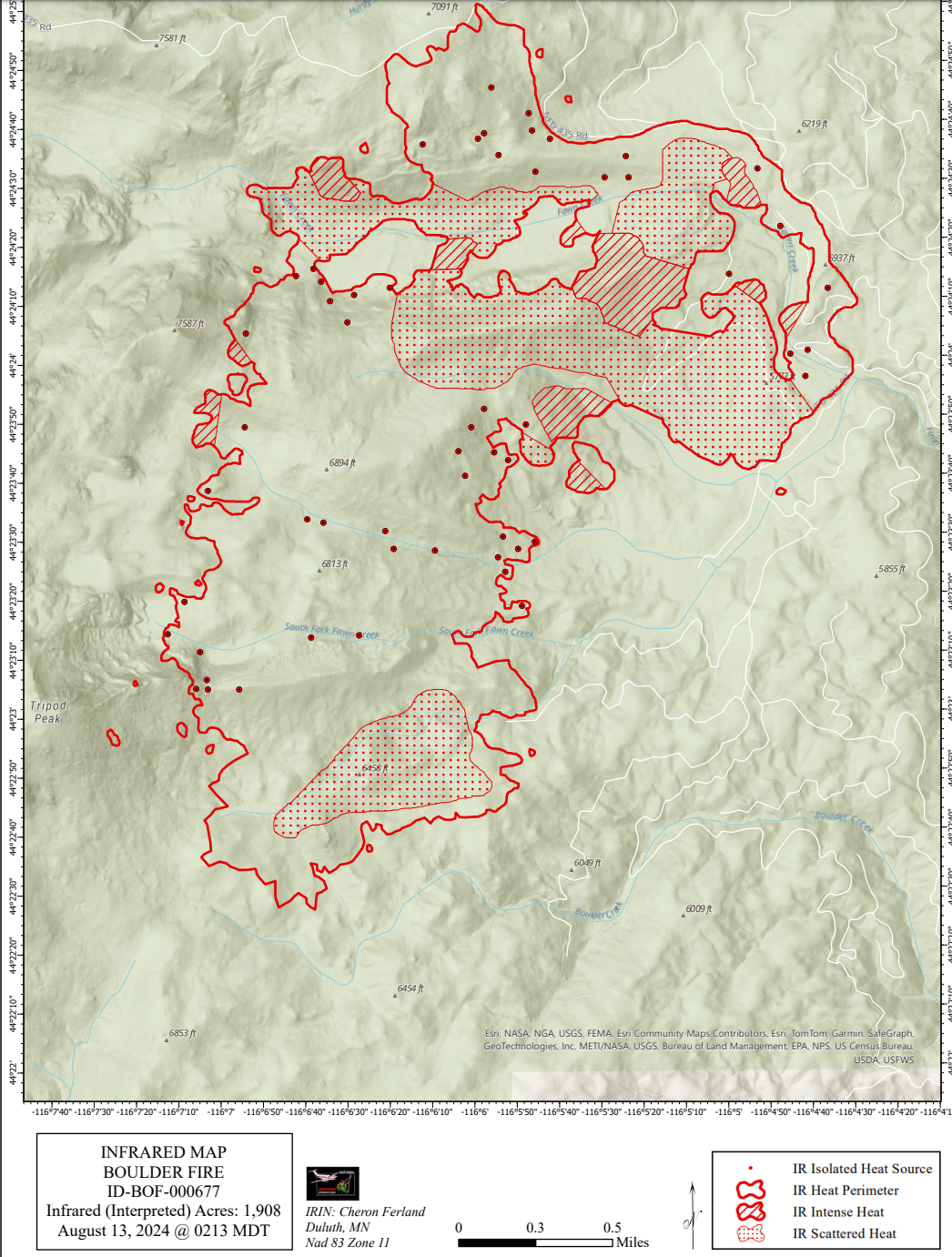
The wildcard on the fire at this point is this East/Southeast area, where it's backing down towards a mix of dozer and handlines. I fully expect fire crews to want to anchor these lines with a firing operation in the next 1-3 days as the fire approaches.
Everything I see about the Boulder fire is encouraging. Again, it's still very active and very much a threat, but crews seem to be pinning this fire down. While containment is (technically) low, I think it undersells the work that has been done on the fire. If I lived in the area, I'd keep an eye on this fire for sure, but I wouldn't be losing sleep over it at this point. Baring a major wind event, I don't see this escaping the current contingency lines.
Dollar Fire
1,580 Acres - 0% Contained
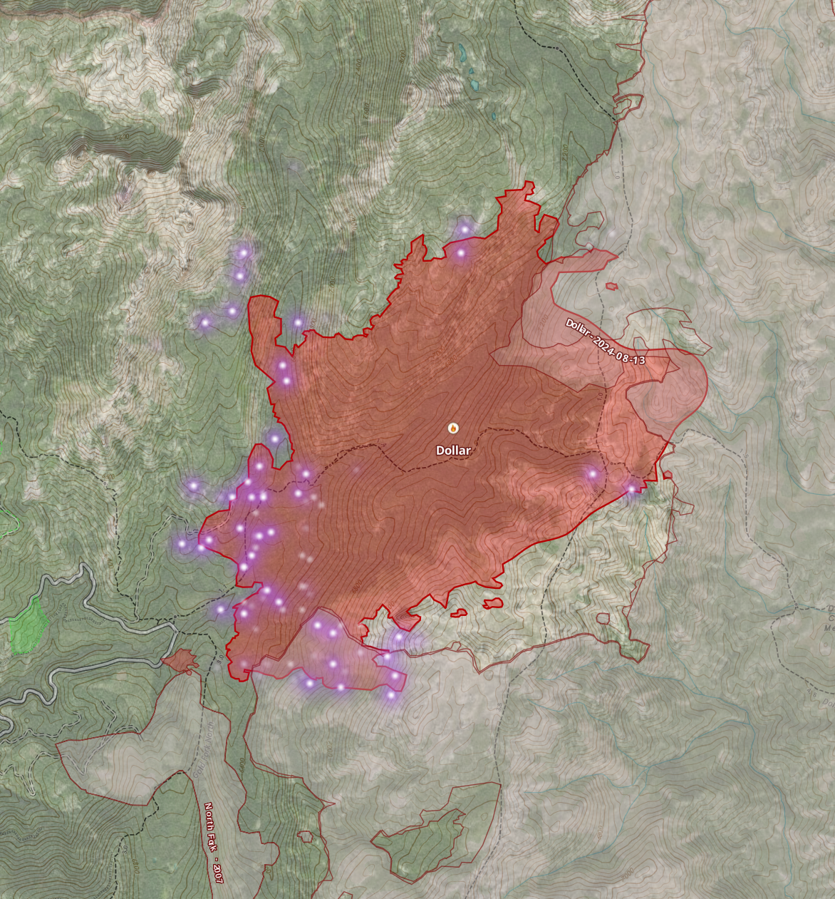
The Dollar fire is largely in monitoring status. Due to existing fire scars, it has almost zero threat of further eastward movement, so it's backing down the canyon towards the west. Fires in this area don't typically make major runs west (especially down-canyon), so we'll likely see light to moderate growth in the coming days. It could make a small run to the northeast, but we're seeing decreased heat on that flank so I'm not expecting it. Fire crews are constantly monitoring the fire and will reevaluate their strategy as resources and conditions change. I don't see this fire threatening anything in the foreseeable future.
Goat Fire
682 Acres - 0% Contained
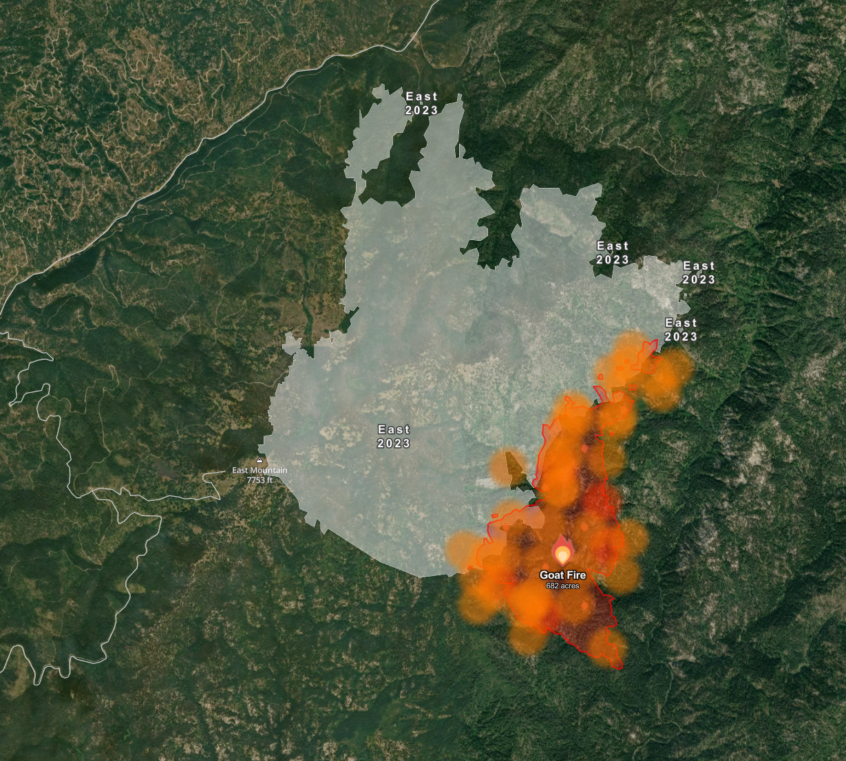
The Goat fire is currently in monitoring status; given limited resources and higher-priority fires in the area, this one will just do its thing unless/until it threatens resources, at which point fire managers will implement point protection. Right now, we're a long way from any such threat. This is because it's burned into the 2023 "East" Fire scar, which should stop major progress toward the Clear Creek Road. The fire has plenty of room to run east, but it will burn into the history of the Monumental, Bearskin, and Rattlesnake Complex fires. The fire is actively monitored, and fire crews will continuously reevaluate their suppression strategy. I'm not paying much attention to this one, and I won't again unless something major changes.
Puma Fire
8 Acres - 0% Contained
The Puma started yesterday (Aug 12) east of McCall on a ridge above Cougar Lake. This fire is still in Initial Attack, but at eight acres, I don't expect full containment during initial attack. That said, I don't see this fire as a threat. It's fairly remote and outside the current canyon it's in, there's a lot of recent fire history. My gut says they'll wrap it up at under 50 acres, but with the right puff of terrain-aligned wind, it could grow to a few thousand acres before hitting natural barriers and existing fire scars. Crews are on the scene and actively working on suppression.
Wolf Creek Fire
1,154 Acres - 55% Contained
Activity on the Wolf Creek Fire has been minimal for several days. I haven't seen any heat detected from MODIS/VIIRS satellite passes since 8/7, and last night's IR flight showed only seven small points of isolated heat well inside the perimeter. Keep in mind this is a timber fire, which means it can hold heat for days and rekindle into a threat, but based on what I see at this point, I find that increasingly unlikely. Current containment shows 55%; most of the contained line is on the East and North flanks and backed up by contingency lines or natural anchor points--baring a hurricane-force wind event, I don't see this fire escaping out of this drainage to threaten Tamarak or homes on the west side of Cascade Lake. I really don't see this fire making any movement at this point. Containment will continue to increase as additional mop-up and cold trailing is completed.
Flat fire
2,313 Acres - 14% Contained
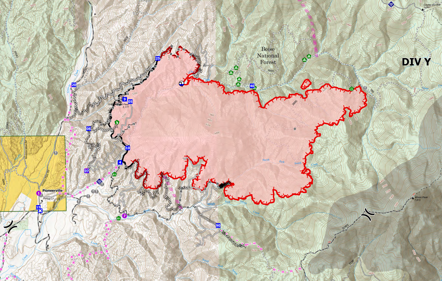
The flat fire near Pioneerville has been very active the last few days. At this point, I think the threat to Pioneerville is fairly small. Crews have dozer lines on most of the western edge of the fire closest to the community. They also have contingency lines in place, with others in progress or planned.
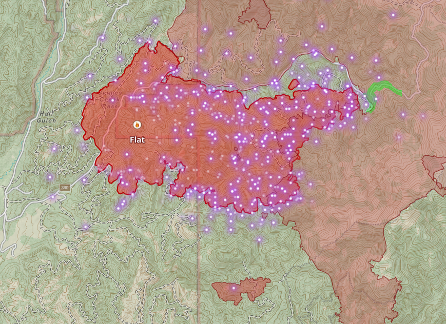
Looking at fire history in the area, you can see that it has reached (and appears not to be burning significantly into) the 2016 Pioneer Fire perimeter. I would expect this to greatly slow any eastward movement, just based on the burn pattern so far. Fire crews appear to be building their dozer line with this in mind, looking to tie into the old burn, preventing much movement south.
I'm not greatly concerned about this fire. It has a bit of room to grow, but I don't think it'll grow out of its current drainage, and it appears crews are making good progress.
Other Fires
Paddock—In my last newsletter, I said I expected the Paddock fire to lose its priority number 1 status on Monday or Tuesday. This was based on my assessment of its reduced activity (aka, almost entirely out). Indeed, the Paddock Fire has dropped from number 1 to number 13. There's only a tiny bit of heat left in one of the ravines on the Butte, it's a mile from the perimeter. This fire is in mop-up.
Bulltrout—The campground at Bull Trout Lake has reopened to the public.
Wapiti—The fire has been very active, covering 3,104 acres now, but it has not backed down the ridge into Grandjean or moved into Baron Creek thus far. I'll take a closer look in a future update.
Bulldog—The bulldog seems to be moving away from Middlefork Road and Crouch. Not much has changed since my last update, but crews have made progress on firing operations and fuel reductions. It seems like the west side of the fire is looking pretty good.
Wrap-up
In general, I'm seeing a lot of great progress on the fires under active suppression. I will be posting short real-time updates as I see them on Threads, but otherwise, based on current behavior, I'll be back Thursday or Friday for the next major update.
Member discussion