August...
Peak Fire Season
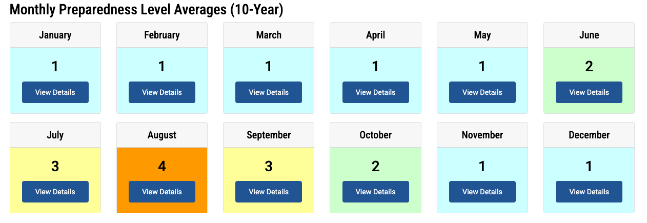
Welcome to August, folks. It is historically the peak of fire activity nationally, with an average national Preparedness Level of 4. The Preparedness Levels (PL) scale used by NIFC categorizes wildfire readiness and resource allocation from PL 1 to PL 5. PL 1 indicates minimal fire activity with available resources. As fire activity escalates, PL 2 and PL 3 reflect increased incidents and the need for more interagency coordination. PL 4 signals significant fire activity and resource strain, requiring national mobilization and prioritization. At PL 5, widespread fires have severely depleted resources, necessitating emergency measures and extensive national support to sustain operations. August is the only month that averages a PL of 4, but of course, we've been at PL 5 this year since mid-July, with only three other years reaching PL 5 before we did this year.
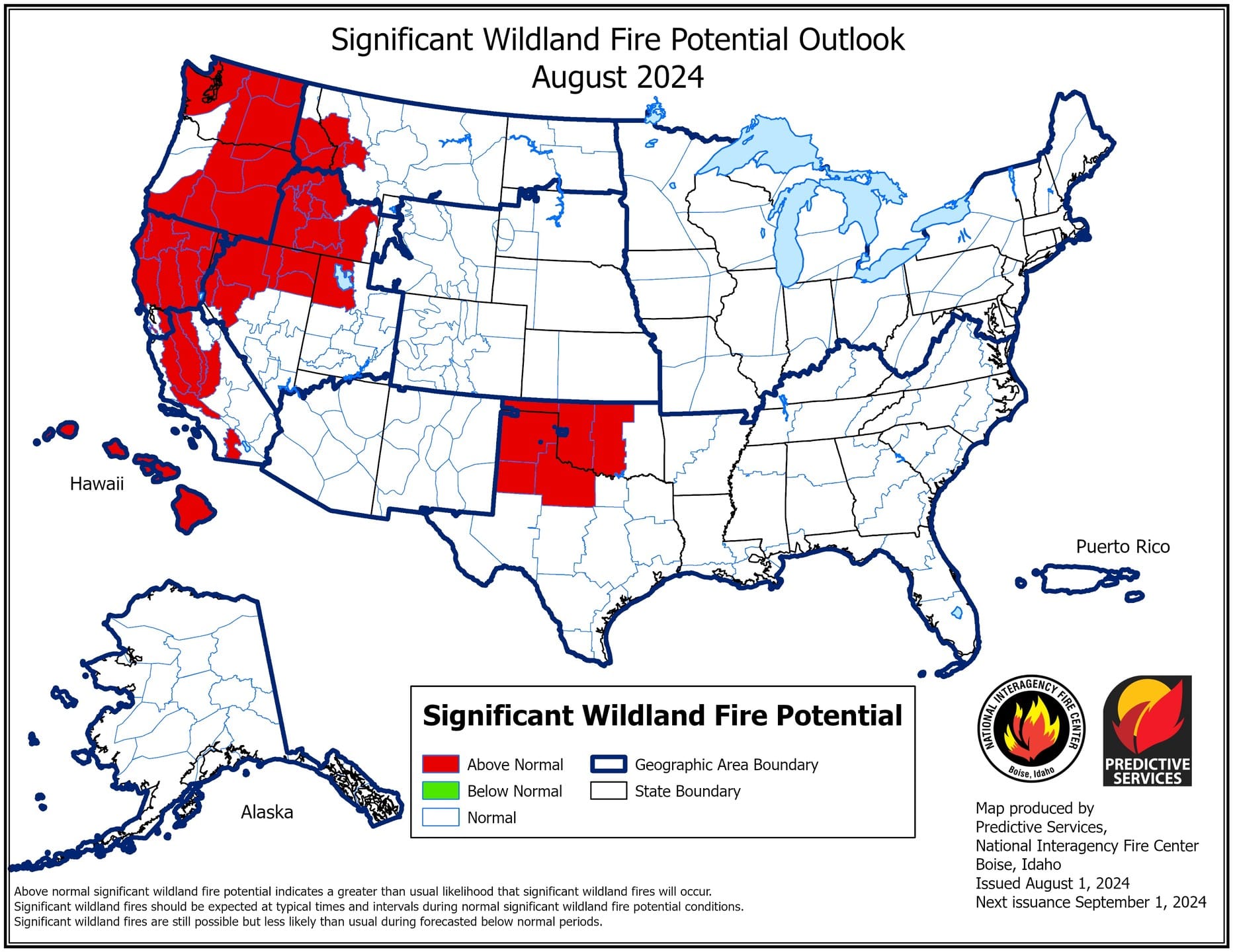
My point is that August is our worst month nationally (and certainly here in Idaho), and we're entering that worst period with resources already stretched insanely thin. NIFC released the Wildland Fire outlooks for August and September – the outlook for Idaho is "Above Normal" for August and September.
Fire Activity
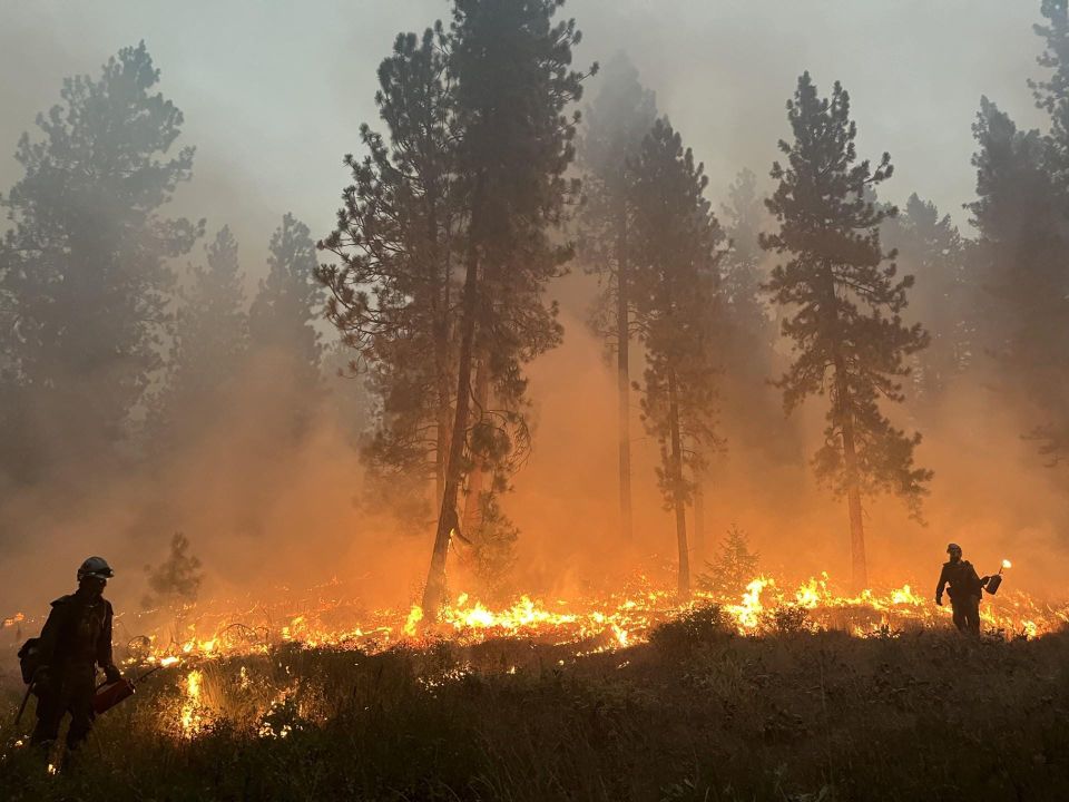
Extreme temperatures are back, along with reduced humidity and a less stable atmosphere we're seeing fire activity ramp back up after a few days of relative quiet. We're going to take a look at one Initial Attack fire that just popped up in the last couple of hours, then a quick update on Limepoint, Wolf Creek and Boulder Fires
Gardner Fire
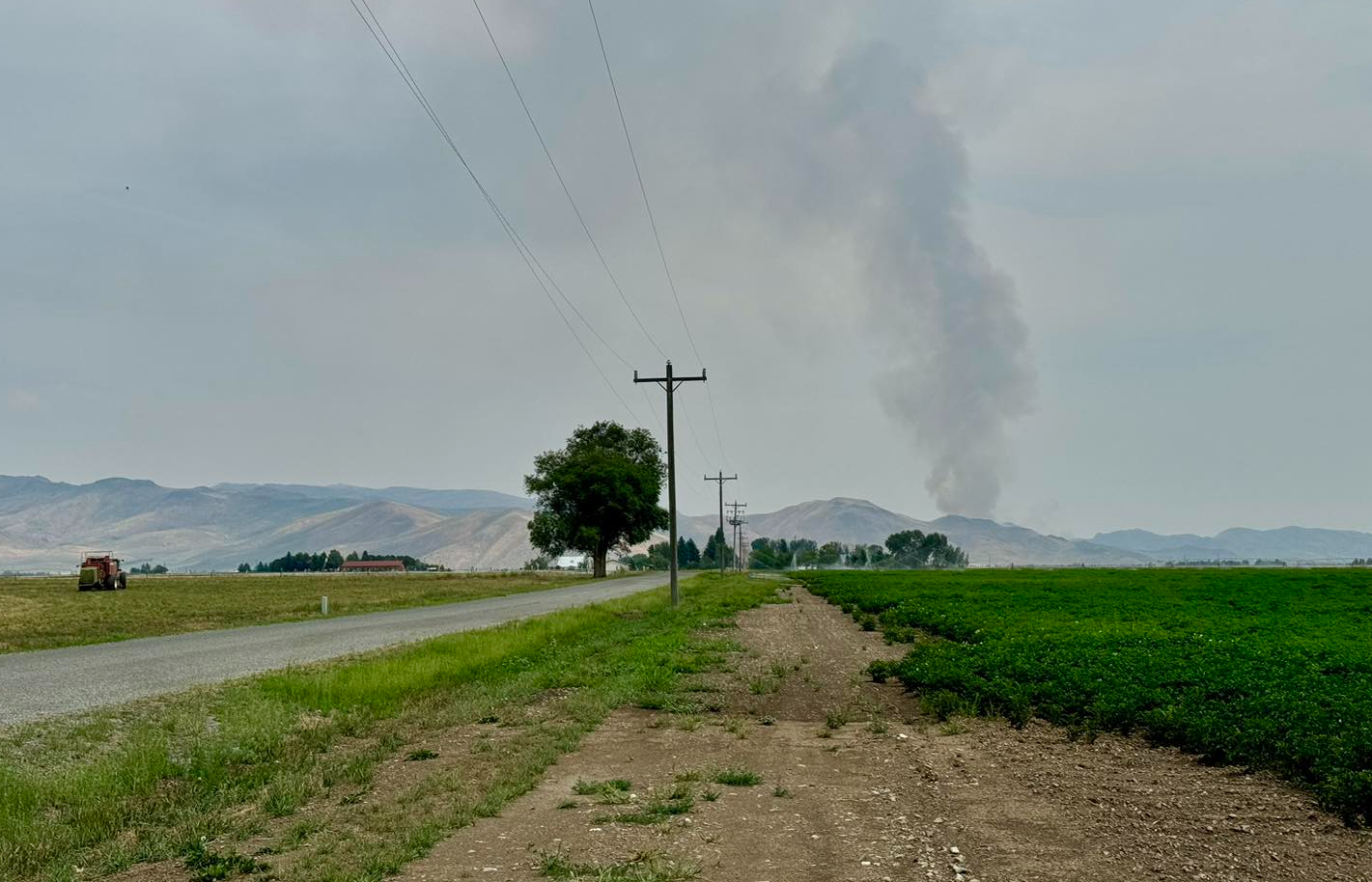
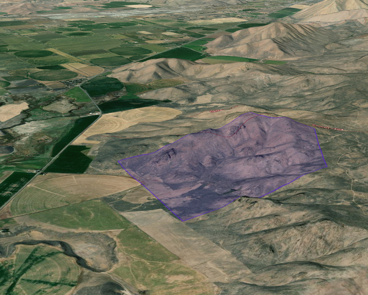
Currently estimated at 150 acres (likely much bigger at this point), this is an Initial Attack fire about 4 miles NW of Picabo (between Bellevue and Carey). This fire is only a couple of hours old, so the information I have is limited... It is burning in grass & sage foothills and getting a very heavy initial attack – there are (at least) 4 engines, a couple of dozers, and four Single Engine Air Tankers working the fire. There are storms trying to build to the south of the fire moving north which would cause a real problem for quick containment. Any storm outflow winds from the south could drive the fire north into pockets of timber – which would be bad. Without some knowledge of current fire-spread rates, it's hard to say what potential this fire has other than to say it's a grass/sagebrush fire – with the right puff of wind it could be a few thousand acres in the blink of an eye.
Based on all the info I have, here's a map of the perimeter as I estimate it (and my estimated perimeter is about 500 acres). This 3D map is SE of the fire-looking NW towards Bellevue. I don't expect an impact on the community at the moment, but and afternoon thunderstorm could result in evacuation warnings in the surrounding foothills.
As I finish this analysis, I'm seeing Large Air Tankers (LATs) responding from Boise and La Grande, OR. Gonna be a busy air show this evening...
Limepoint Fire
Since our last look at the Limepoint fire, activity has significantly increased. Two primary areas of activity, the North flank and the South-East corner. I I think
There is still a possibility of fire working it's way into Cuprum from the south, but control measures taken by fire crews have greatly reduced this threat. Fire lines were crossed and additional evacuations were triggered.
Yesterday under Red Flag conditions the fire crossed several firelines on the Limepoint Fire and grew 3,000 acres, mostly on the northern and eastern flanks. This morning, Adams County Sheriff’s Office issued a Level 3 (Go Now!) evacuation for residents in Wildhorse and Level 1 (Get Ready) for Mill Creek. Level 3 (Go Now!) evacuations are still in effect for Cuprum and Bear, and Level 2 (Get Set - Be prepared to leave) are in effect for Ditch Creek and Paradise Flat. If you have evacuated areas under Level 3 evacuations, please do not go back. (Limepoint Fire Update - Inciweb)
The good news is that, though firefighting is still taking place in and around Cuprum, I think we're pretty safe there at this point. I did hear rumors earlier that firefighters were being pulled out of Bear for their safety as the fire was approaching. Everything I see says those rumors are not true – I'm not seeing any verifiable reports, it's not reflected on the Ops map from 2 hours ago, nor am I seeing any heat signatures in the vicinity of Bear yet. I think this rumor came from the fact that they pulled a bunch of resources out of Bear and shifted them further south into Wildhorse, Barber Flat, and Paradise Flat areas, given the fire approaching them but that was possible since Bear is not in immediate danger.
Bear is still at risk and will be for several days, but right now, it looks like firefighting efforts have stopped the current progression towards the community. There is still a chance fire could get established south of the area and move north into it, but that scenario is most likely a longer-term threat.
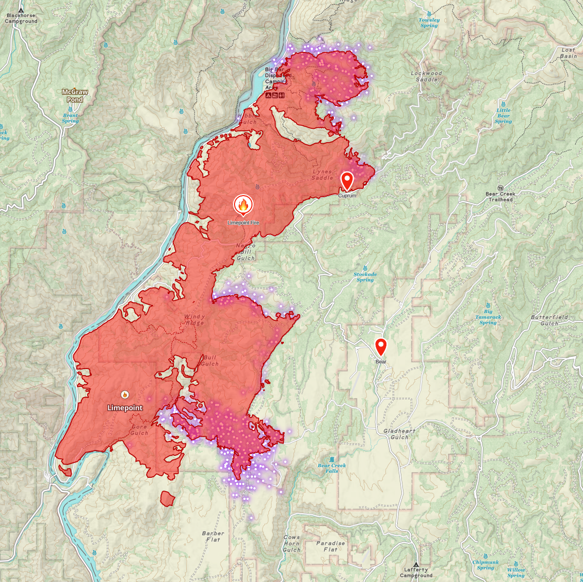
On this map, you'll see three areas of heat (the bright dots). The north end is burning north and hitting some nasty terrain – that's going to be a problem. The south end is burning south and favoring east; crews are trying to prevent it from getting established in the Wildhorse area, dropping into Cows Horn Gulch, and also trying to protect high-voltage power lines in the area. In the middle, the third area is where crews are trying to pin fire on a dozer line. There were some firing operations in the area last night to add some black to the lines to help stop the advancing fire. I don't see any heat signatures across the mapped dozer lines at the moment, so I'm hopeful this activity won't progress anywhere.
This is still a very dangerous fire with tons of potential for growth and the potential to directly impact communities and there are storms predicted that could easily make that happen. But, I am encouraged by they progress I'm seeing on the Operations map.
Wolf Creek
The Wolf Creek fire near Cascade Lake has seen much more activity in the last 24 hours. That being said, I don't see a ton of change from my last commentary on the fire. Most of the activity is on the southern end of the fire, burning (mostly) away from Tamarack at this point. That being said, it is still a threat, and there are evacuation "Ready" notices in place.
Significant work has been completed on the ground to keep the fire from moving north. The main threat is the fire crossing the ridge and getting established on the east side above Cascade Lake. So far, there have been a few spotfires across the ridge, but they have been handled pretty quickly.
I will be taking a close look at tonight's reports and maps, as it appears that the fire crossed containment lines on the south side. I'm not sure if the fire actually crossed these lines or if it burned into other areas and went around the lines, or what. Multiple helicopters and water scoopers are working the fire both on the north end (which isn't showing much heat left) as well as the much hotter southern end.
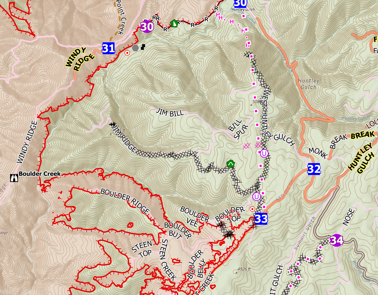
Boulder Fire
There's not much to say about the Boulder (burning near Cascade) that wasn't said in my last update. The fire has grown to 620 acres, and most of the Activity is on the north side of Tripod Peak. There has been some direct firefighting, but much of what I see is indirect and contingency work. Realizing this, I just looked at last night's ICS-209 report from the fire, and they confirm this on the last line of their planned actions.
Utilize appropriate suppression tactics to keep the fire to the smallest possible size. Keep the fire from spreading onto private land. Use natural barriers where possible to limit the exposure to personnel and the amount of constructed control line. (emphasis mine)
All fire managers want to use natural barriers to limit exposure and resource impact. But given this fire's status on the priority list (#5 in the Great Basin Coordination Center region as of last night), this fire isn't going to get the resources other fires are getting right now. So, taking an approach where you go direct where you can and otherwise back up to give yourself plenty of time to establish fuel breaks using natural barriers (in this case, rocky areas, large meadows, and existing FS roads) is an efficient use of the resources you do have. The West Mountain road looks to be the primary line and is well north of the fire at the moment, much of it it's in a large meadow which will make construction of a fuel break go much faster.
I'll likely have more of an update on this fire in the next day or two once we see what it does with more heat and atmospheric instability, but at the moment, it looks like the fire is going to grow north and west with limited southerly growth (due to terrain and contained fireline), I'm hoping we don't see any east movement and expect to see additional information about.
Pony Fire
I swear I'll hit send on this eventually... Another new IA fire came in while I went through the other fires.
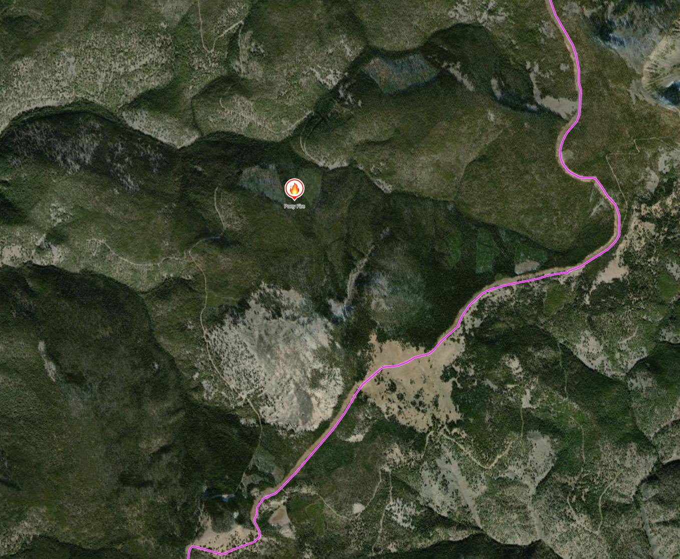
I wouldn't normally report on a 3-acre IA fire, but this one is in my old stomping grounds and has a lot of potential for growth. The Pony fire is burning on the Salmon-Challis just north of Phelan Mountain, just west (thankfully!) of the Ridge Road. It is miles south of the 2022 Moose Fire Scar and well east of the 2000 Clear Creek Fire Scar – as far as I can tell, there's no fire history in this immediate area. And, OMG, there's a ton of thick dead or stressed lodgepole in the area. Depending on where the fire is exactly (there are some older timber harvests in the immediate area), Initial Attack may be able to catch it. If not, we're gonna burn some lodgepole...
The good news, as I said earlier, is this fire is west of the Ridge Road – which was originally prepped as a fuel break back in 2000 when we thought the Clear Creek was gonna make yet another epic run and end up burning the whole city of Salmon. The clear creek didn't, and the fuel break has been improved over the years as other fires have threatened the town. Only one fire has ever crossed the Ridge Road fuel break – the 2022 Moose fire jumped the contingency line on its late-season last hurrah multi-mile run, losing steam after it crossed the fuel break just as it entered the town's watershed.
Wrap-up
Alright, folks, that's it. I may post a short update (to be fair, this was supposed to be a short update...) on the Limepoint or Wolf Creek fires tomorrow. If not, I'll return on Monday with another look at things.
Please leave a comment via the website, reach out on Threads or Mastodon, or email me at zeb@idahofire.org if you have feedback or questions.
Thanks for reading!
Member discussion