Aug 11 - Paddock, Snag, etc
Today's agenda includes updates on the Paddock and Snag fires and a high-level look at fires in the West Mountain and Middle Fork complexes.
Initial Attack
In the last seven days, 115 new fires have been reported in Idaho. 74 of those have reached full containment, and 41 are not fully contained, though many are nearing containment and are no longer a threat.
Initial Attack has been light to moderate after storms came through the mountains the last couple of nights. We will see additional new fires from these storms, mainly in the Central Idaho mountains, west into Cascade, and up into the Clearwater region. Depending on the management strategy for specific fires or areas, new fires in the wilderness may or may not prompt an immediate suppression effort. But you'll see a fast and decisive response to any new fire outside the wilderness.
Just north of the Paddock, the Rile fire was a range fire started by lightning late Saturday evening, about an hour before dark. It had an Air Attack, a lead plane (aka "bird dog"), a scooper, two large air tankers on fire almost immediately, and ground crews responding from the Paddock Fire. This response held the fire to about 40 acres and is in monitoring status today.
The Elmore Fire, which started east of Nyssa two hours ago, received a similar response, and all air resources were returned to base within an hour. The fire is listed at 50 acres, but from what I'm seeing, it got a quick knock and is no further threat.
All across the state, Initial Attack resources have been doing a stellar job, pinning down most new fires over the last week or two. But of course, they can't catch all of them, especially fires burning in Timber.
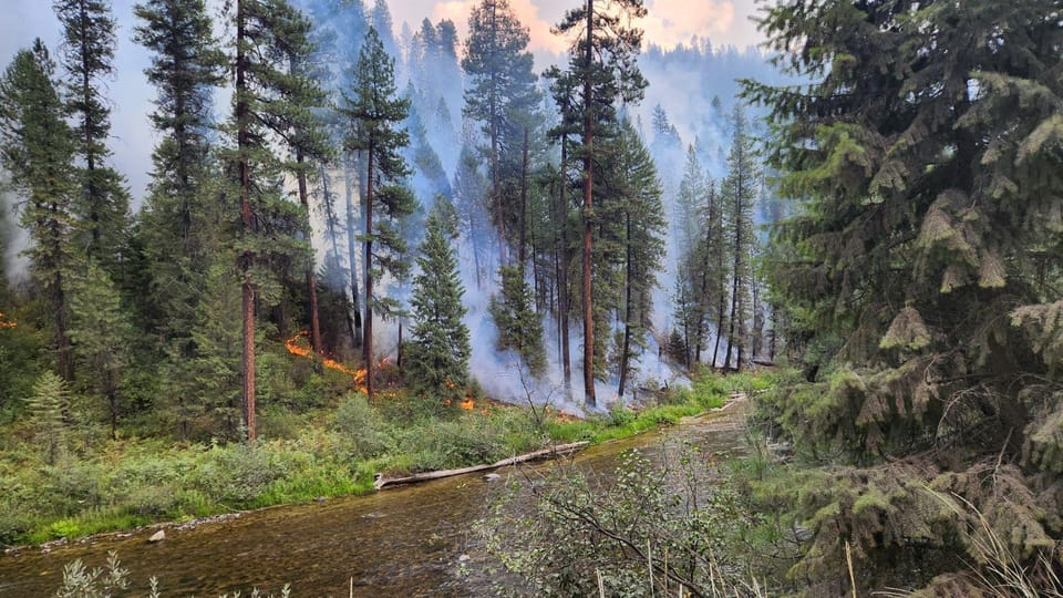
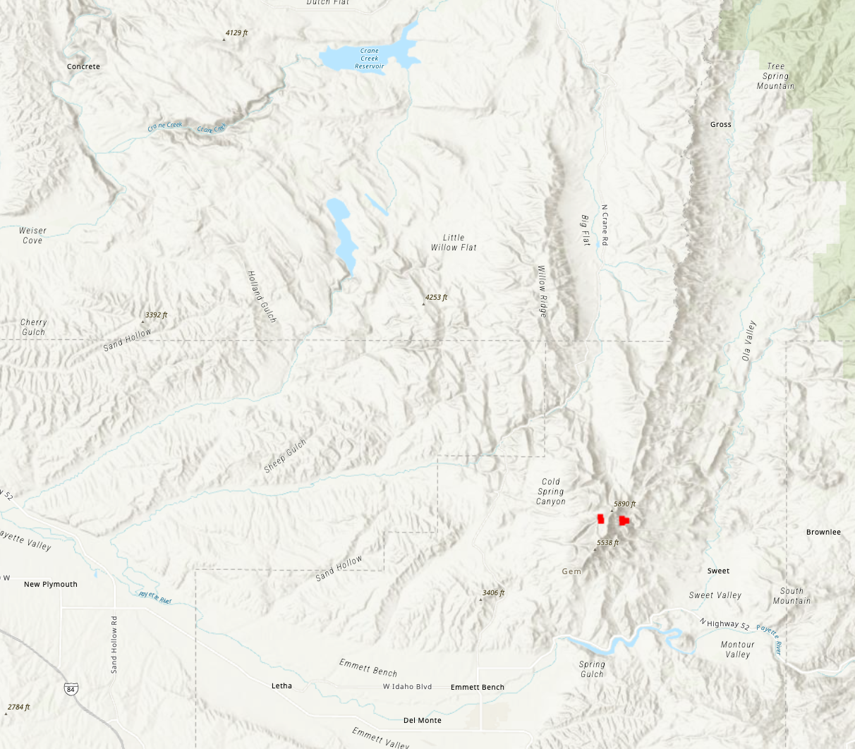
Paddock Fire
The Paddock Fire is currently 187,185 acres and is officially 5% contained. It is still the #1 priority fire in the Great Basin Coordination Region, though I expect it to lose that designation on Monday or Tuesday.
I know I've mentioned this recently here and on social media, but we've got a lot of new subscribers, so I'll just say it again before I dive in. Containment percentage is a percentage of the total fire perimeter "contained." There are over 80 miles of fire perimeter on the Paddock Fire. That 5% means that roughly four miles of perimeter meet the minimum definition for contained. But this says nothing of fire activity or the threat of fire growth – this is especially true on grass and sage fires, where fires can't lay dormant for a few days and then flare back up like they often do in timber (especially subalpine fir). When a range fire is cold, it's done. It will take a few days for fire crews to mop up the perimeter and cold trail enough to mark it as contained.
Heat
With that said, let's look at the heat detected over the last 24 hours.
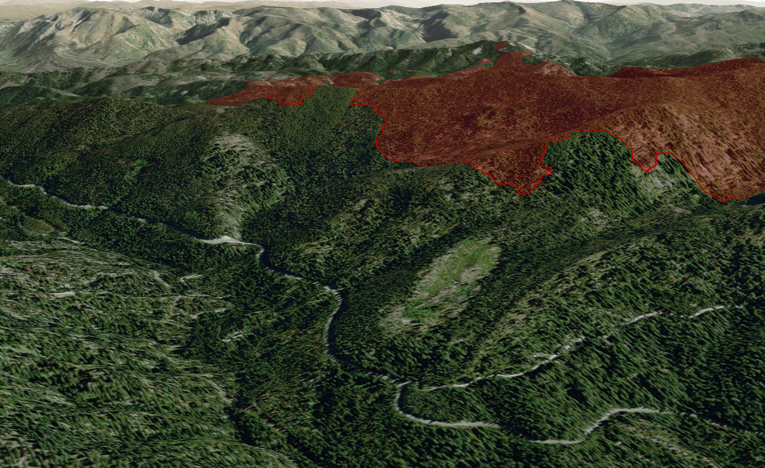
The last 24 hours of Satellite VIIRS (Visible Infrared Imaging Radiometer Suite) data shows that out of the almost 200,000 acres of the fire area, only two small pockets of heat/fire were detected. Both of these areas are on the Butte, and (having spent a lot of time on that butte back in my telecom days) I can tell you they're in steep canyons with brush and a few trees. As I write this, a helicopter is doing bucket work to cool that eastern heat pocket. This fire would be out cold if not for those trees and brush holding heat. Also, it's worth noting that the fire perimeter is almost a mile from this heat, meaning it's surrounded by black and extremely unlikely to go anywhere. This is what we call interior burning.
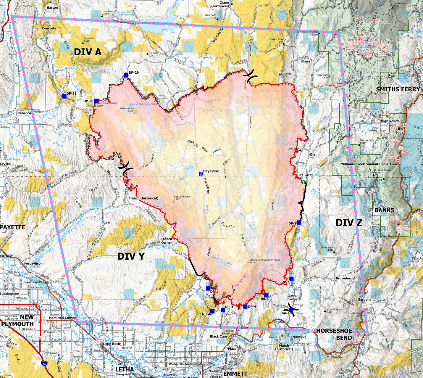
Looking at the current operations map for the fire, if you trace the perimeter, you'll see that this fire meets dozer lines, roads, creeks, or handlines in almost all areas. There are a few areas where it doesn't hit an anchor point, but many of those areas were painted with fire retardant.
Long story short, there's only a tiny bit of interior heat left; the perimeter shows no heat, and this is a grass/sage fire. Nothing about this fire makes me the least bit concerned for further growth.
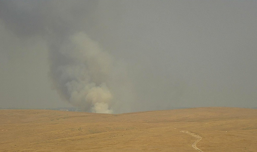
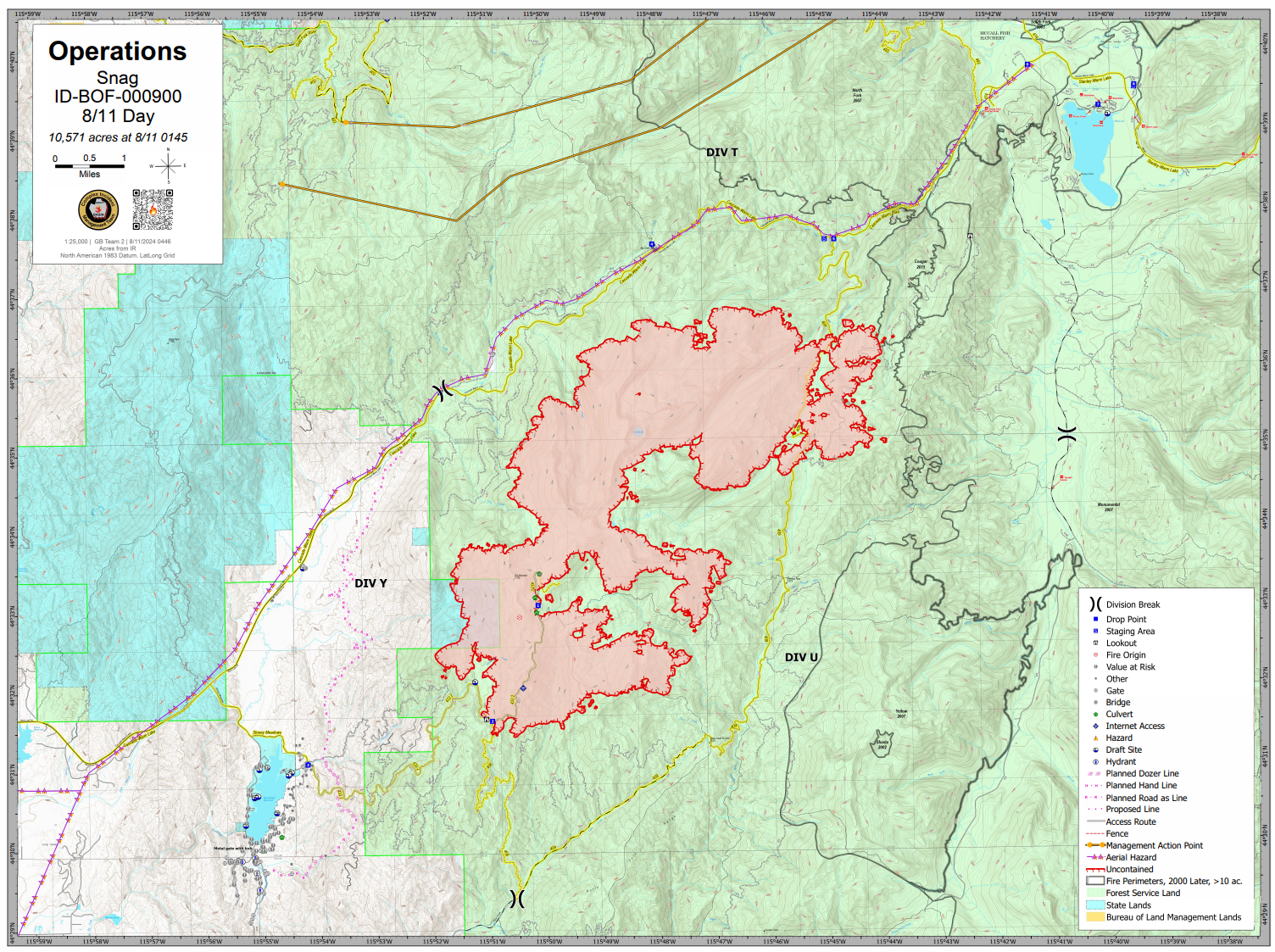
Snag Fire
10,571 Acres
Near Warm Lake
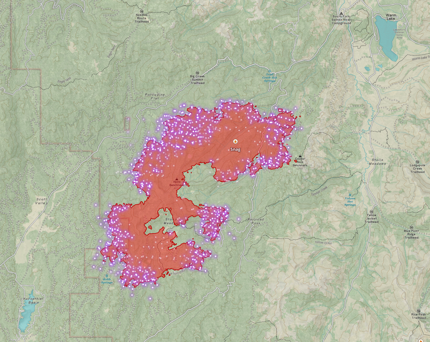
Of the West Mountain Complex and Nearby Middle Fork Complex, the Snag Fire is certainly the most active. It has grown to 10,571 acres and is showing intense heat on all perimeter areas. The fire currently threatens the Warm Lake road and Idaho Power Infrastructure, feeding remote areas like Yellow Pine, and will soon threaten Warm Lake and possibly Horsethief.
Warm Lake Road
Per the last update I've seen, the road is currently limited to area residents. But I fully expect that road to close as the fire reaches steeper ridges above the road; once burning material starts rolling down the hill, they'll close it to everyone. (and likely start a firing operation if they haven't already).
Anyone choosing to stay in Warm Lake or other areas access via the Warm Lake road should be aware that the Middle Fork Complex is burning in the Deadwood area, so don't plan on that as an escape route. If you need to go south, you'll probably go through Bruce Meadows towards Stanely.
Potential
I think the biggest threat of this fire right now is to the Warm Lake Road. It could continue burning towards and reach Horsetheif but I wouldn't expect any major runs in that direction. It will continue burning toward Warm Lake, though as I said in my last update, the fire will most likely be a different beast when it reaches the areas as it enters fire scars with limited tree canopy. Within that old fire scare, numerous opportunities for fuel breaks and/or large burnout operations should be successful point protection for Warm Lake. Looking at the fire history it appears the immediate area around Warm Lake was largely saved during the previous fires. Those old fires add a buffer zone now that should make defending the resources at the lake area easier.
Given limited resources, steep terrain, a heavy fuel load, and hot, windy conditions... I don't see them trying to stop the fire's eastward movement before it reaches those old burns, which it's probably starting to do as I type this. I suspect they'll try to hold Warm Lake Road with substantial firing operations, and they'll look to create and hold a southwestern line between the fire and Horsetheif Reservoir. (I'm seeing a potential/proposed line on their ops map for today, but it's not yet in place)
In short, this fire will keep actively burning with little direct attack. They'll prep indirect containment (dozer and old roads) on the west side, try to hold the Warm Lake road to the north, and let the fire burn into old fire scars to the East prior to engaging there. You may see some tanker work to cool any active runs, but most of what we'll see will be indirect, given current priorities, resources, and conditions.
Other Fire updates
Wolf Creek
Looking pretty cold. Containment is now 52% and 1,154 acres.
Boulder (West Mountain Complex)
The large firing operation (burnout) seems to be going well. Most of the heat has been in the Fawn Creek area where crews are doing ground and aerial ignition to reinforce the fireline. I'm confident in their strategy at this point and don't expect any further threat from the fire, though a lot of work is still needed to improve containment.
Dollar (West Mountain Complex)
1,337 acres, 0% contained. The Dollar fire has burned eastward into old fire scars, which will slow it; I can't imagine any suppression work will be done on the east side of this fire. Crews are monitoring the movement of the western flank and will implement additional suppression or point protection if the fire leaves its current drainage. I don't think this fire is much of a threat to anything, and it won't get much in the way of resources until something changes.
Bulldog (Middle Fork Complex)
Over the last couple of days, we've seen more activity on the Bulldog, though most of that activity is moving away from threatened resources. Crews are reinforcing the middle fork road through fuel reduction and firing operations and are working to hold the fire east of the road. I don't foresee them having any issues doing so based on current/predicted activity. Eastward, the fire is burning into old fire scars, which should greatly reduce any growth in that direction. Crews have been constructing direct and indirect lines along the south flank, reinforcing with firing operations to stop the movement towards Crouch. Based on what I see at the moment, I think they'll be successful.
Flat Fire
The flat fire is currently threatening Pioneerville. It's grown to 1,010 acres and is 0% contained. Crews are actively building direct and indirect lines to prevent movement toward Pioneerville. This afternoon, they are being supported by Scoopers (working out of Deadwood Reservoir).
Anderson & Nellie Fires (Middle Fork Complex)
These are actively burning and not currently threatening much. Crews have point protection in place for the lookout and communications infrastructure and are otherwise monitoring growth looking for opportunities.
Wrap-up
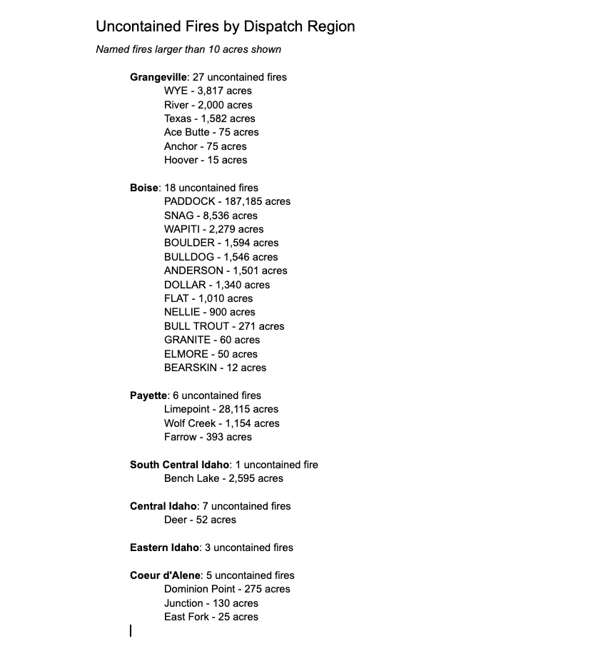
There are currently 67 uncontained fires active in Idaho. Here's the list by Dispatch region, showing fires larger than 10 acres. Note, though, that some of these fires (Bench Lake, Paddock, etc.) might not show full containment but are no longer a threat.
Also, if someone could convince Boise Interagency Dispatch to turn off the caps lock when entering fire names into the computer, my brain would appreciate it 🤣.
Member discussion