A Brief Reprieve
Summary
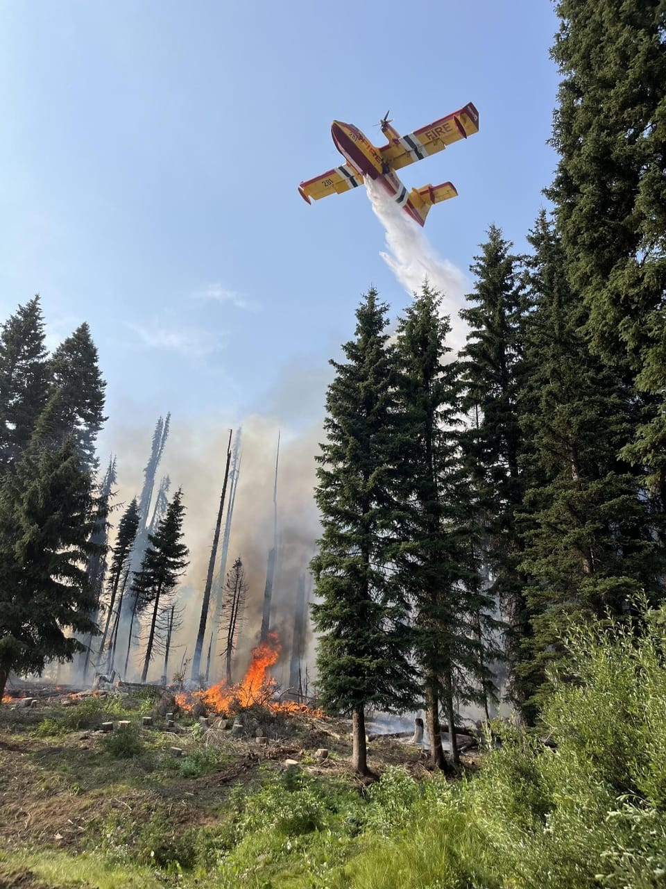
The last few days of cooler temperatures, higher humidity, and more stable weather across the state have allowed fire crews to make good progress on most active fires. Coupled with winds pushing smoke from the enormous Park Fire in California to our south – it's been a refreshing few days. Given how the fire map looked last week, we're lucky to be as calm as we are – not that we're calm. Massive kudos to the Initial Attack crews; things would be very different right now if not for them.
This less-hot weather and improved air quality have been a nice reprieve, but we've got a lot of fire season left, and we're setting up for record heat again—don't let your guard down.
Fire Danger
Fire dangers across the state range from moderate to high, with higher forecasted. We have a chance of dry lightning in the next several days; current estimated lightning ignition efficiencies are as high as 20%, especially in the SW Idaho highlands.
Notable Fires
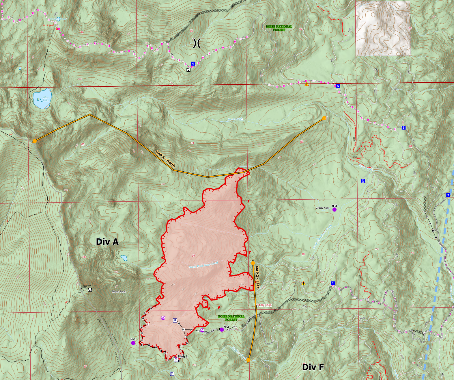
Gwen Fire - Grangeville Region - Myrtle, Idaho
28,805 Acres
34% Containment
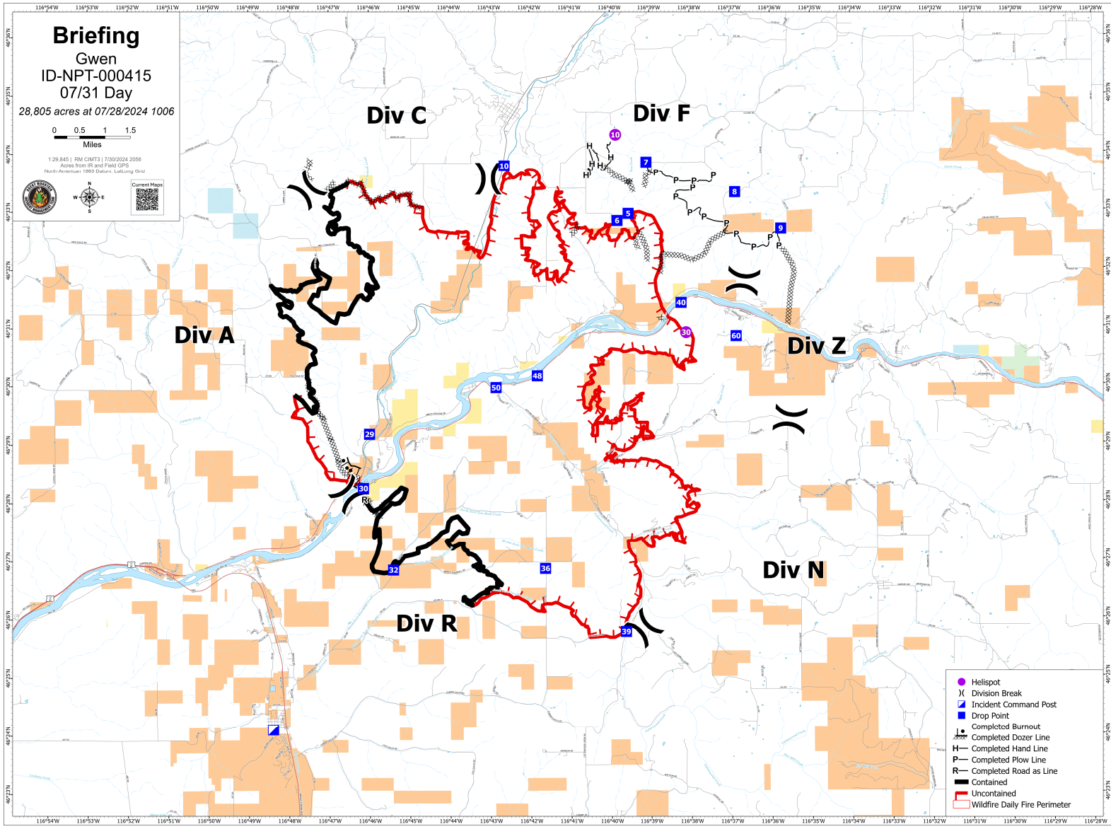
Great progress has been made on the fire over the last few days. Last night's InfraRed mapping flight could not fly the fire due to the weather, but I'm not seeing much in the way of active heat signatures on satellite. Daily reports say there is still scattered/isolated heat within the perimeter, but significant progress is being made "cold trailing" the perimeter.
Looking at the Ops maps for the fire, much of the western side is contained, and the eastern side is being tied into contingency lines. Depending on conditions and remaining heat, the fire crews may need to do some burnouts to remove the potential for fires to make a run at and possibly escape these lines that the fire hasn't quite reached. That being said, I'm really not seeing much in the way of activity on this fire. I don't expect to see any further growth from this fire.
All evacuations on the Gwen fire have been moved back to level 1 "Ready" status.
Limepoint Fire - Payette Region - Cuprum, Idaho
note: the Oxbow fire merged with the Limepoint and is being managed and reported as the Limepoint fire now
17,908 Acres
0% Contained
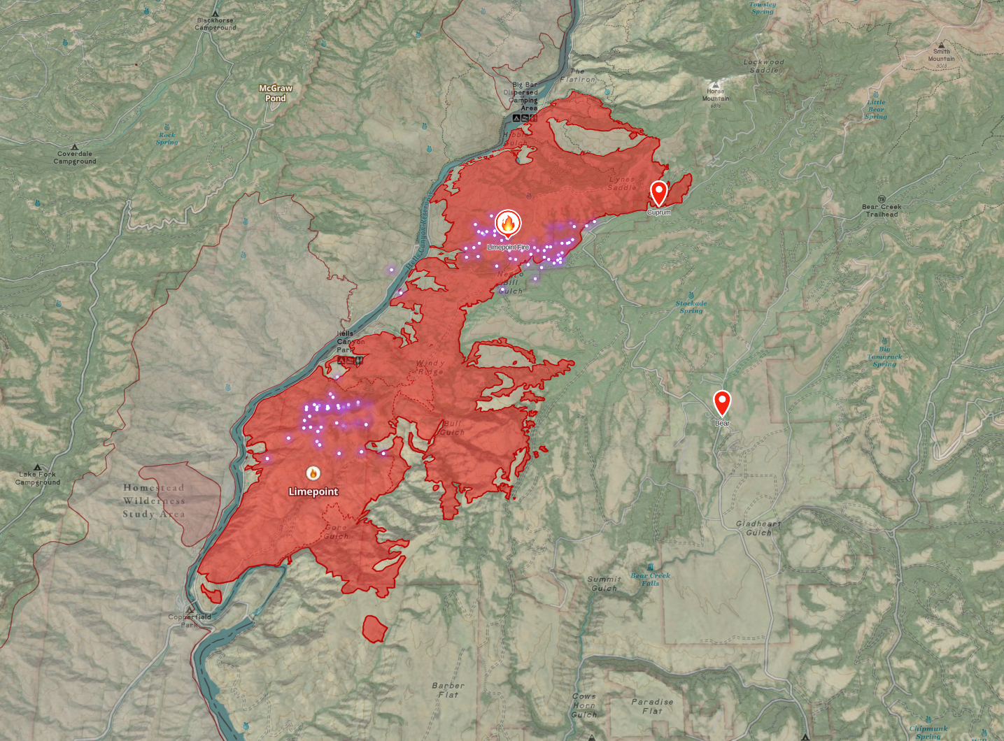
Evacuation orders are in place for Cuprum and Bear communities.
Last week, this fire was pretty low on the priority list, and resources were limited, understandably. It's very remote, and while there are impacted communities, they weren't as immediately threatened as other fires within the Great Basin coordination center area. As we're seeing progress on other fires, this fire is now Priority #1 in the Great Basin Coordination region, and as such, it is getting more resources – which is good cause it has a lot of growth potential. Today's briefing says 90% of structures in Cuprum have been prepped, and crews are monitoring the community 24/7.
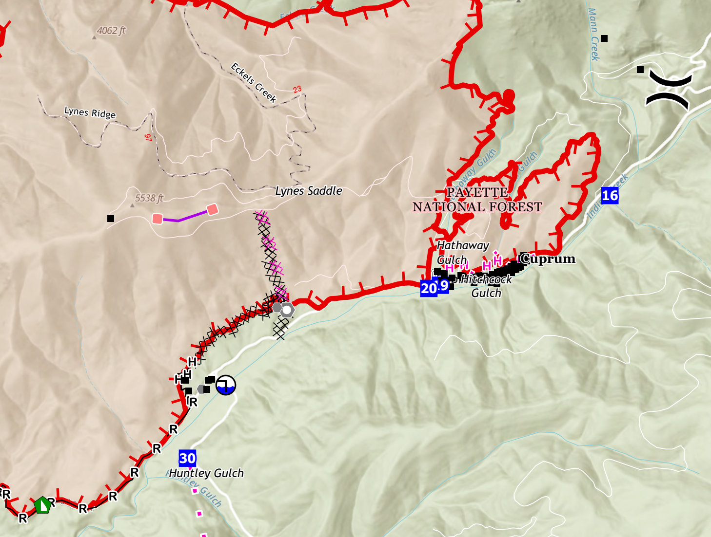
It's a bit hard to see, given the clutter around Cuprum on their ops map, but they have done burnouts in the area and have established a fireline. I do not expect that fire will impact the community from this side. You can also see the fire has burned up to the dozer and hand lines further down Indian Creek (bottom left). It isn't contained yet, but the fire is unlikely to cross these lines. I am still concerned for the Cuprum area as fire could run up the SE side; you can see planned lines (likely in progress now) in the Huntly Gulch area that would hope to prevent that run.
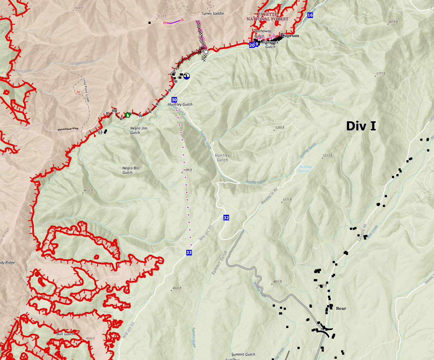
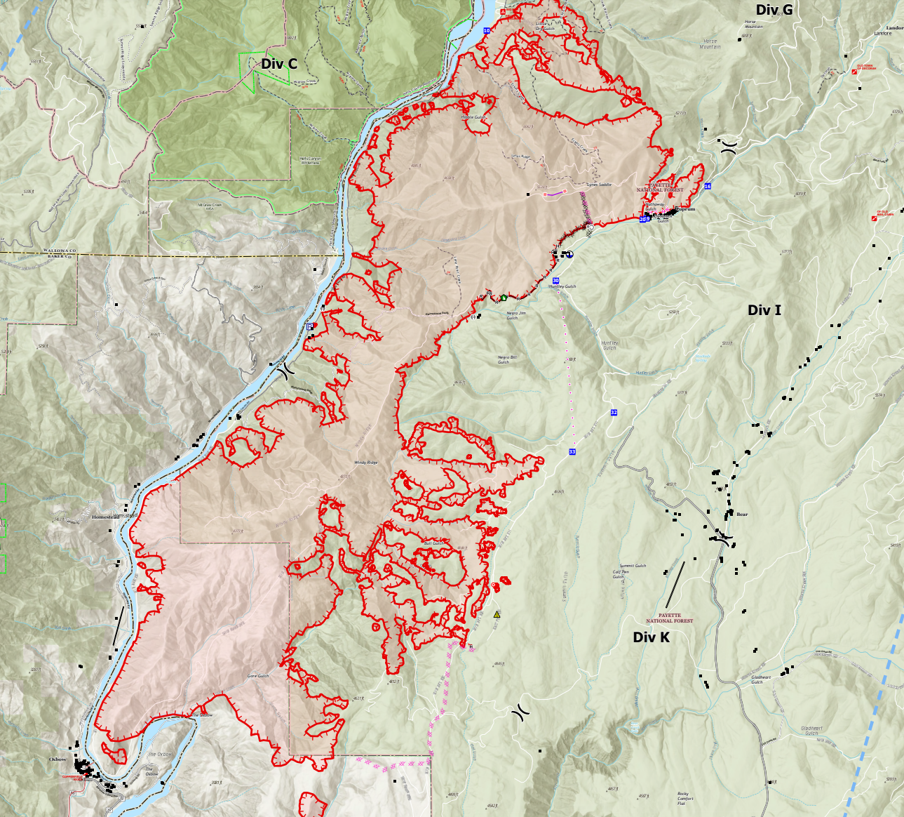
Long story short, this fire can potentially impact Cuprum and/or Bear. I'm somewhat optimistic about the progress I see so far, but there's still a significant growth threat to the east and northeast. I'll be keeping a close eye on this one.
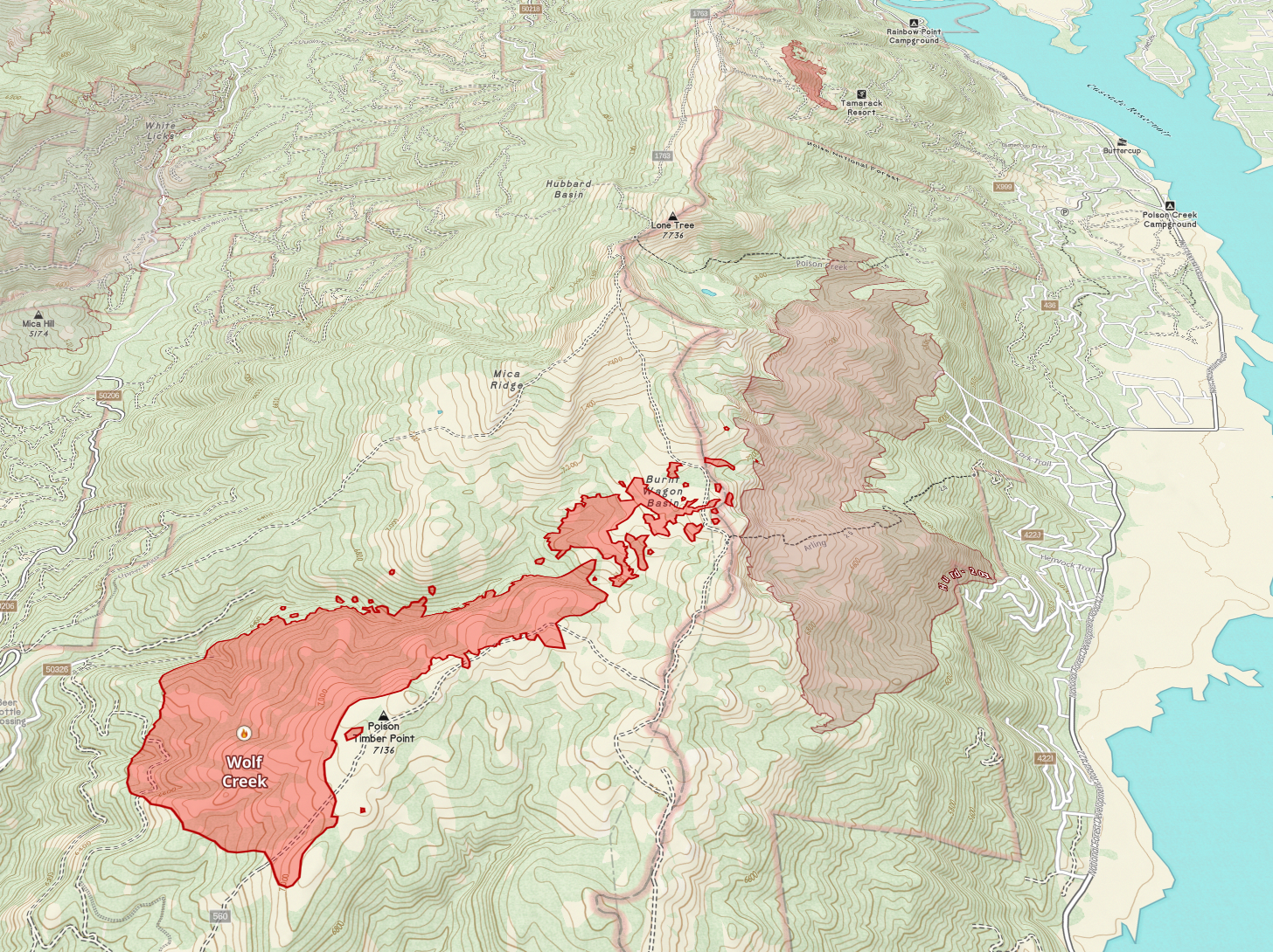
Wolf Creek Fire - Payette region - Tamarack Area
909 Acres
0% Contained
Anyone remember the four corners fire? Yeah, about that...
Great Basin Team 7 has taken command of the fire, which is now Priority 3 in the Great Basin Coordination region. Team 7 is managing both the fires near Cascade (Wolf Creek, Boulder) and the Fires on the west side of the Sawtooth (Wapiti, Bulltrout).
This fire has received wetting rain, but it still has potential, and we'll see an influx of resources to reflect that threat as it moves up the Great Basin priority list.
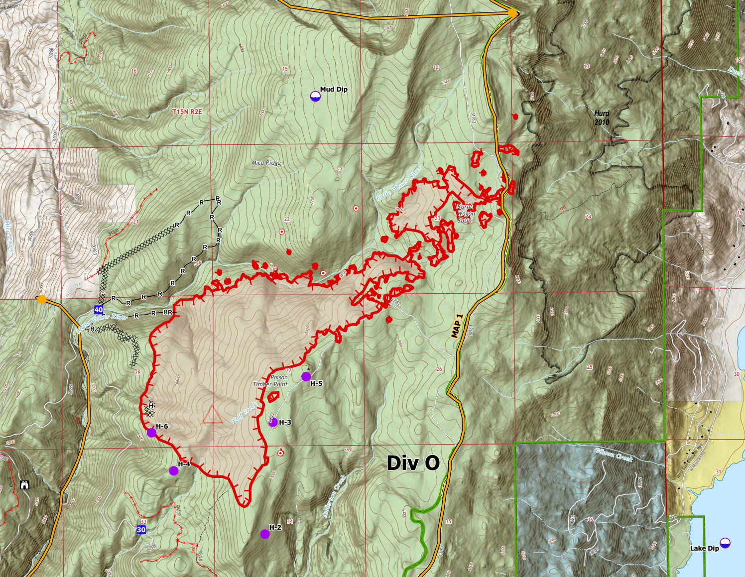
The main goal is to keep the fire on the west side of the ridge out of the Cascade Lake Area and Tamarack Ski areas. Level 3 "Ready" evacuation notices went out today. But, so far, the crews have managed to keep the fire from getting established east of the ridgeline. That's largely thanks to a TON of work by air tankers over the last several days. On the ground, crews are bringing dozer and hand line up the ridge to the north. We'll see more information in the next 24 hours now that there's a management team in command.
This fire may goof around and not do anything more than it has. Or... with the warming weather, it could find the right fuel pocket to establish a run and make a real mess. There is fire history on the east side of the ridge (HURD 2010) that will help to some extent, but I'm not sure what fuel load there is now.
Boulder - Payette region - Cascade, ID
554 Acres
0% Contained
Much of my commentary on the Wolf Creek fire applies here, as this one has the same management team and is just further south and on the Cascade side of the ridge.
This fire shows 0% contained, but there are fire lines around the southern perimeter of the fire; I'd expect to see containment increase as those lines are mopped up. That being said, the fire does appear to have crossed both Management Action Points (MAP) defined on their ops map. However, I haven't found what those actions are... But you could expect to see some "READY" evacuation notices to the north and east of this fire, given those action points, the pending extreme heat in the forecast, and perhaps additional contingency work.
This fire is now priority #2 in the Great Basin Coordination region, so as resources get reallocated, I'd expect the assigned personnel to increase over the next two days. We'll get more information in the coming hours now that GB Team 7 took command today.
Like the Wolf Creek fire, this fire could goof around and not do much, or it could get the right weather in the next few days and make some crown runs through heavy fuel loads. I'm generally optimistic that it won't and that the crews are making good progress on direct lines, and they'll have time to complete their contingencies. But record high temps are predicted later this week, so we need to keep an eye on this. And if you do get an evac notice in the next day or two, please pay attention to it.
Thunder Fire - Central Idaho - Salmon, ID
This will be my last look at the Thunder fire unless there is a significant change. I don't consider it a threat at this time. Nothing else to say other than EXCELLENT work by the Salmon-Challis Initial Attack - they caught this fire in 30mph winds.
Bench Lake Fire - Central Idaho - Redfish Lake
Redfish Lake recreation complex has reopened. This fire will smolder until a season-ending event, but it poses no further threat to Redfish or Stanley. I will do an update on this fire later in the season as I have a chance to survey the area and confirm my thoughts about the fire, but overall, it's certainly not the catastrophic scorched earth event that many feared.
Fire Counts by Dispatch Center
South Central Idaho: 2 uncontained fires
- Bench Lake - 2595 acres
Eastern Idaho: 1 uncontained fires
Boise: 5 uncontained fires
- Boulder - 325 acres
- Bulltrout - 280 acres
- Wapiti - 64 acres
- Bearskin - 12 acres
Coeur d'Alene: 14 uncontained fires
- Junction - 250 acres
- Dominion Point - 100 acres
- Grandmother - 60 acres
- Camelback - 25 acres
- East Fork - 25 acres
Central Idaho: 3 uncontained fires
- Thunder - 2474 acres
- Deer - 52 acres
Payette: 3 uncontained fires
- Limepoint - 17908 acres
- Wolf Creek - 909 acres
Grangeville: 23 uncontained fires
- Gwen - 28805 acres
- WYE - 3400 acres
- Billy Creek - 3155 acres
- River NPT - 2000 acres
- Texas - 1582 acres
- Rock Creek - 677 acres
- Shepp - 100 acres
- Cherry - 50 acres
- South Grade - 30 acres
- Ace Butte - 12 acres
Member discussion