Paddock Fire - 8/9
Good evening, folks; I'm just dropping a quick analysis on the Paddock Fire. I've been watching fire activity across the state this afternoon, and while it is an active day, nothing notably differs from my update late last night. I will be offline for much of the evening tonight, as the last three days have been non-stop. I'll check in a couple of times on the new fires just to make sure nothing is exploding, but otherwise, I'm going to spend some time with the fam and catch up on sleep.
More Storms, More Fires
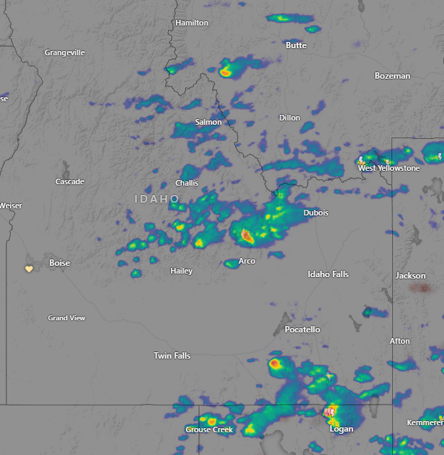
Before we jump into Paddock, I will say that I'm monitoring thunderstorms with winds and dry lightning across the East Central Mountains and Southeast Idaho this afternoon. These storms are already responsible for several new Initial Attack fires in Southeast Idaho; I'm certain we'll see some in Central Idaho as well.
Paddock
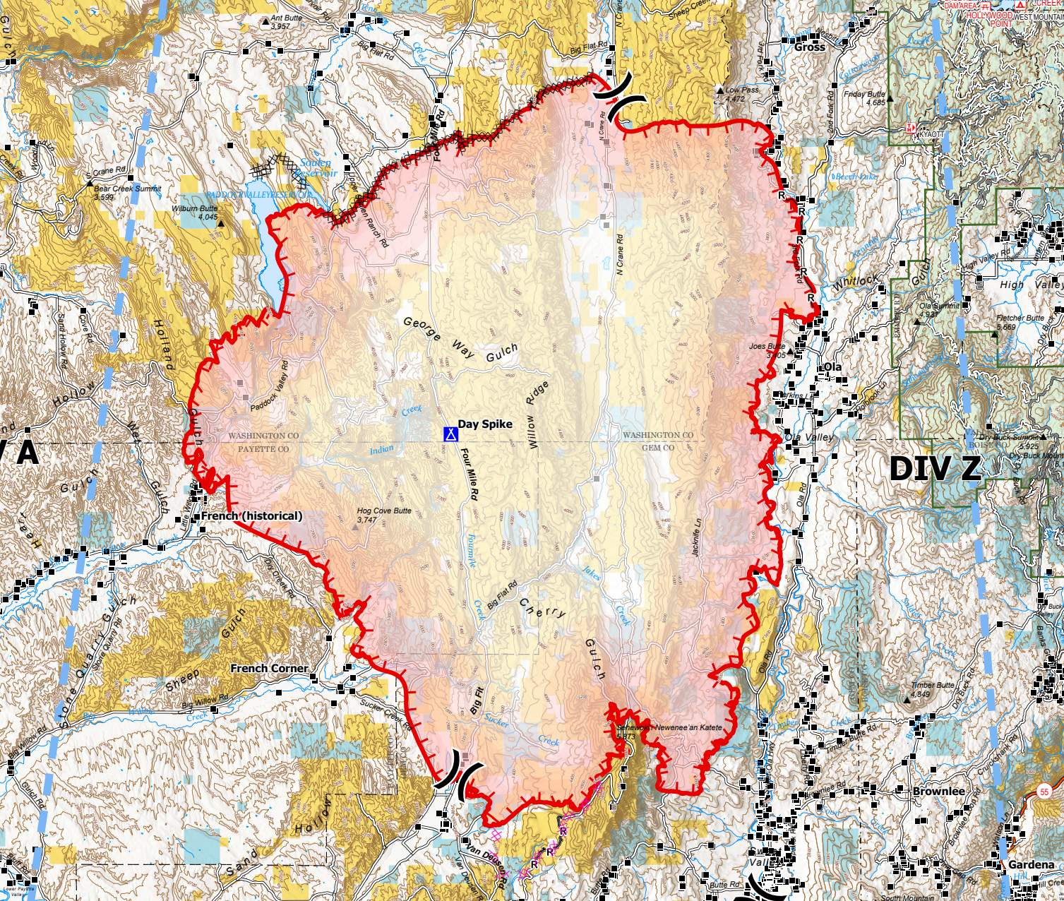
Officially, the Paddock Fire is now listed at 153,757 acres, but that number is based on an estimated perimeter as of 11 AM on the 8th, so it is almost 30 hours old at this point. My own perimeter estimate this evening puts the fire within sight of 200,000 acres. I think my numbers came out to 197,000, with 185,000 for a more mosaic burn pattern, so I'd expect somewhere in the 180-205k acres. Which is big, just in case you were wondering.
Nevada Team 3, Type 3 is now in charge of the fire, which has an estimated cost to date of $2,000,000 (almost all of that is in retardant and water drops). When you see a nice round number like that, you know it's a fairly rough estimate, which is typical for fires in Initial Attack or just into large fire incident status. We'll see that number increase and get more accurate as the Incident Command Team's Finance crew gets into full accounting.
Containment?
Officially, the fire is at 0% containment. But for an area of fire perimeter to be considered "contained" it must meet a standard that we're not going to see much of within the next 24-48 hours. Simply put, there this fire has at least 60 miles of fire perimeter. There aren't enough firefighters to hang around and mop up firelines enough to get a section to a contained status. The firefighters we have on this fire are moving from hotspot to hotspot, doing point protection, and looking for opportunities to limit growth. Once they get a bit of black protecting an area or holding a line, they move on, as is typical for large-range fires. But we will see containment start to come up, soon-ish.
Analysis
What I'm seeing at this point is encouraging. The insane amount of tanker work, probably well over one million dollars in one afternoon, seems to have prevented the fire from crossing Sweet Ola Road and Third Fork. Crossing the valley and reaching timber would have been a likely catastrophic outcome. I mentioned this last night, but I'm seeing that section of fire today is cold – no notable heat signatures at all in that area. If I were in the High Valley area or anywhere west of Highway 55, I'd breathe a huge sigh of relief today. All in all, north of Sweet, I think this end of the fire is buttoned up.
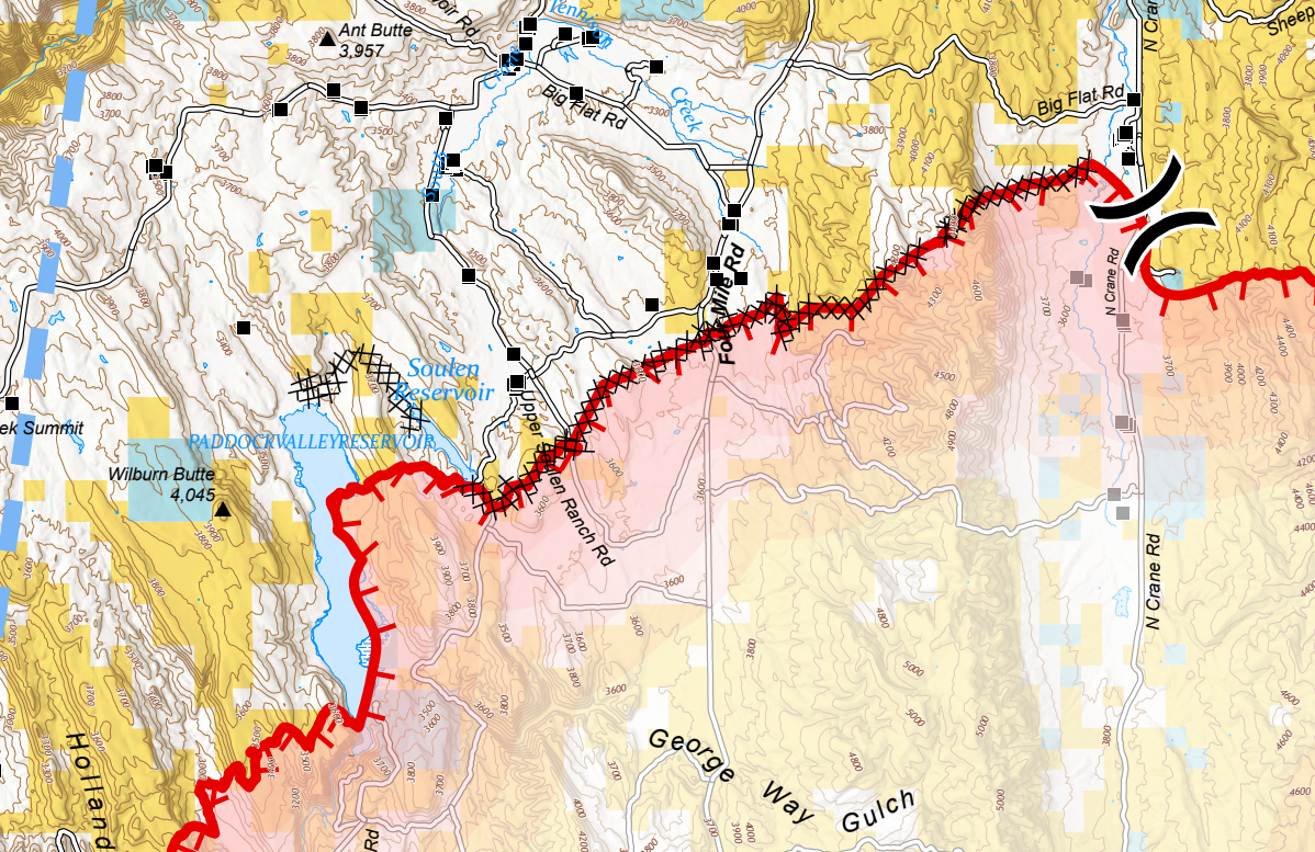
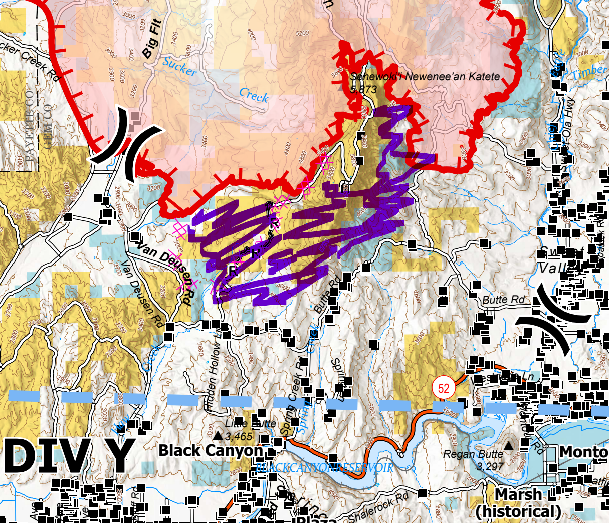
Moving north, there's a dozer line between N Crane Road and Paddock Valley Reservoir. You can see the fire here butts up against the dozer line, this area doesn't meet the containment definition yet, but it is extremely unlikely that we'll see northern progression across this line.
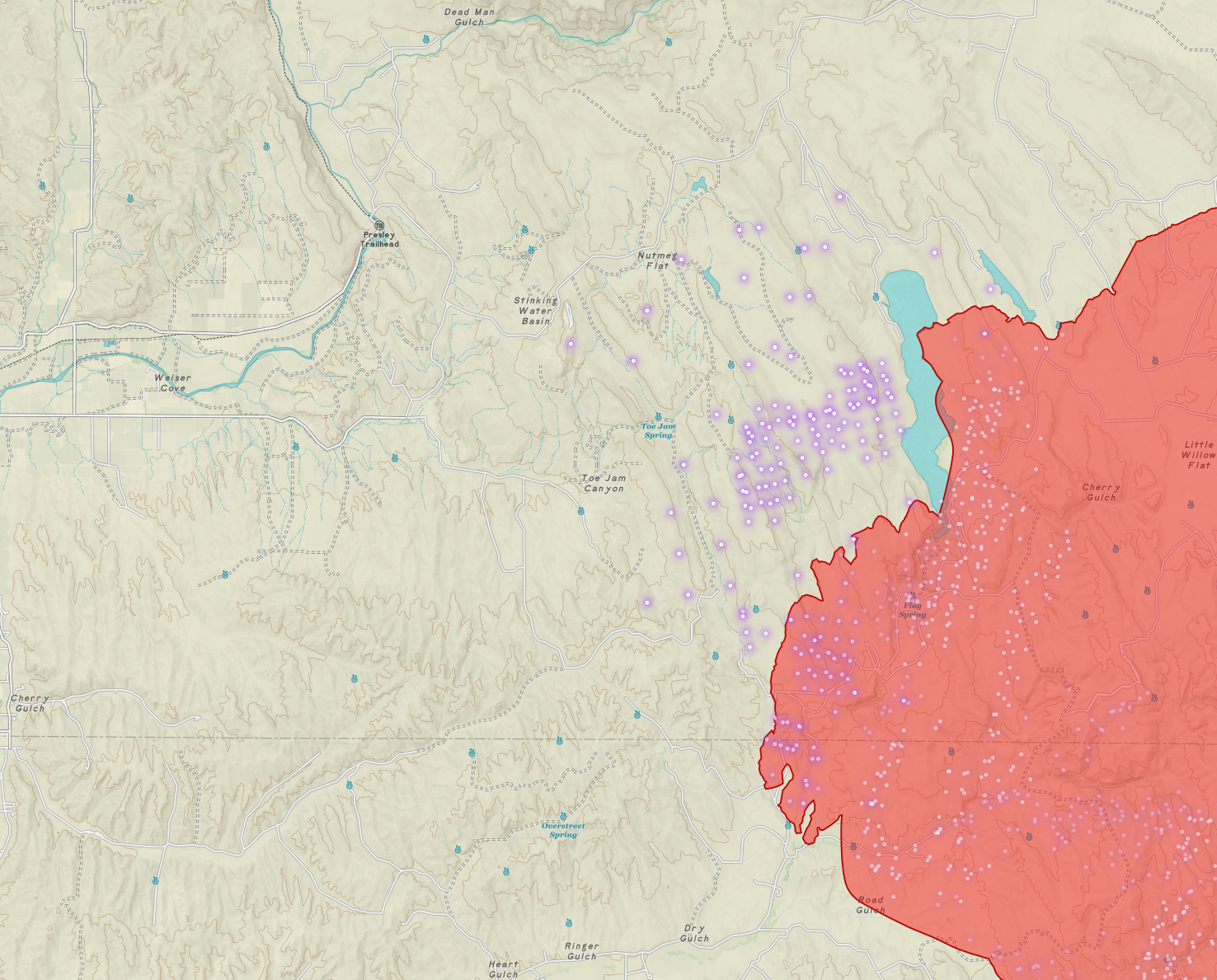
Swapping to one of my maps now, you can see the fire is growing west of Paddock Valley Reservoir today. Much of this afternoon's tanker work has been on this flank; it appears they're trying to hold South Crane, Skow, Sand Hollow, and a couple of other connecting roads to stop the fire prior to reaching the Weiser River. This will be done via a mix of tanker work, firing operations (aka burnouts or back burns), point protection, and strategic dozer work. I'm not on the ground there of course, so I can't say for certain, but I generally have a good feeling they'll hold their intended line given the situation and conditions as I understand them at the moment.
EDIT: As I'm preparing to post this, Tanker 912, one of the "Very Large Air Tankers (VLAT), has entered the stack over the fire, having flown up from Sacramento. I can't overstate how massive these planes are nor how effective they are in a range fire environment. I'm watching it paint a line paralleling Skow Road to protect several homes along the road. You don't get a VLAT drop approved without an immediate threat to life or property; they're HELLA expensive and there are only four of them last I looked. I don't know what the current DC-10 contract is right now, but that one retardant drop is somewhere around $120,000 delivered. It looks like they're headed over to Pocatello, the closest VLAT-capable tanker base other than Boise, which has an insanely busy tanker ramp right now. It's much more efficient to have the big bird fly a bit further to reload than to disrupt the ramp at BOI to accommodate it.
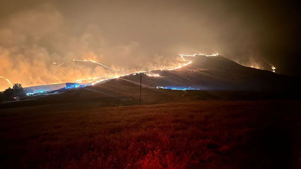
Alright, let's examine the South end of the fire around the Butte. I was up late in the evening/wee hours talking with one resident in the Butte area. I'll drop photos from her below. The fire came over the Butte and worked its way down toward Butte Road. Firefighters were doing nighttime dozer on the south end of the butte to ensure the fire couldn't work its way around the face and make a run up the valley. This ensured the fire would back down the butte, a much more manageable fire-fight. As the fire approached Butte Road, crews showed up with dozers, engines, drip torches, and flare guns to conduct a nighttime burnout along the road, creating a nice buffer of black. This operation stopped the fire and saved the ranches and homes along the road. That was just before dawn this morning, so it's not on any map yet, but from talking to people in the area, I believe the fire has been held at Butte Road, and I don't foresee any further growth to the south or southeast. You can see this area I'm talking about, beautifully colored by yours truly on the ops map below (area marked in purple).
Speaking of residents in the Butte area, I'll drop in a few photos sent to me by @flingerstakes last night and this morning. I had told her what to expect as the fire crossed the butte; from talking to her and looking at all her photos, they did exactly that and executed the firing operation perfectly, thus saving the ranches and homes on the Southeast side of the butte. Kudos to the crews involved!
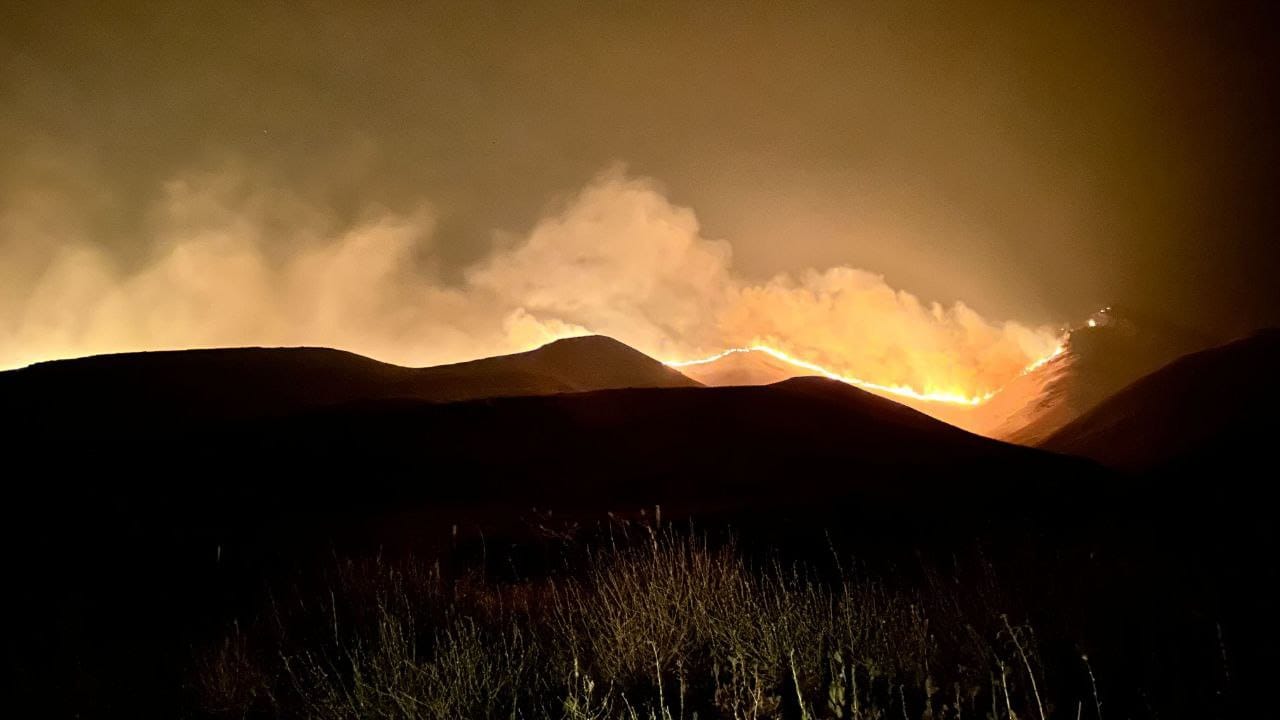
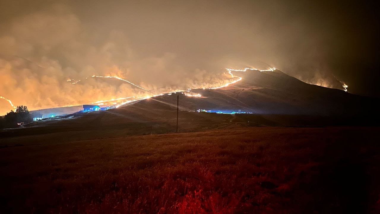
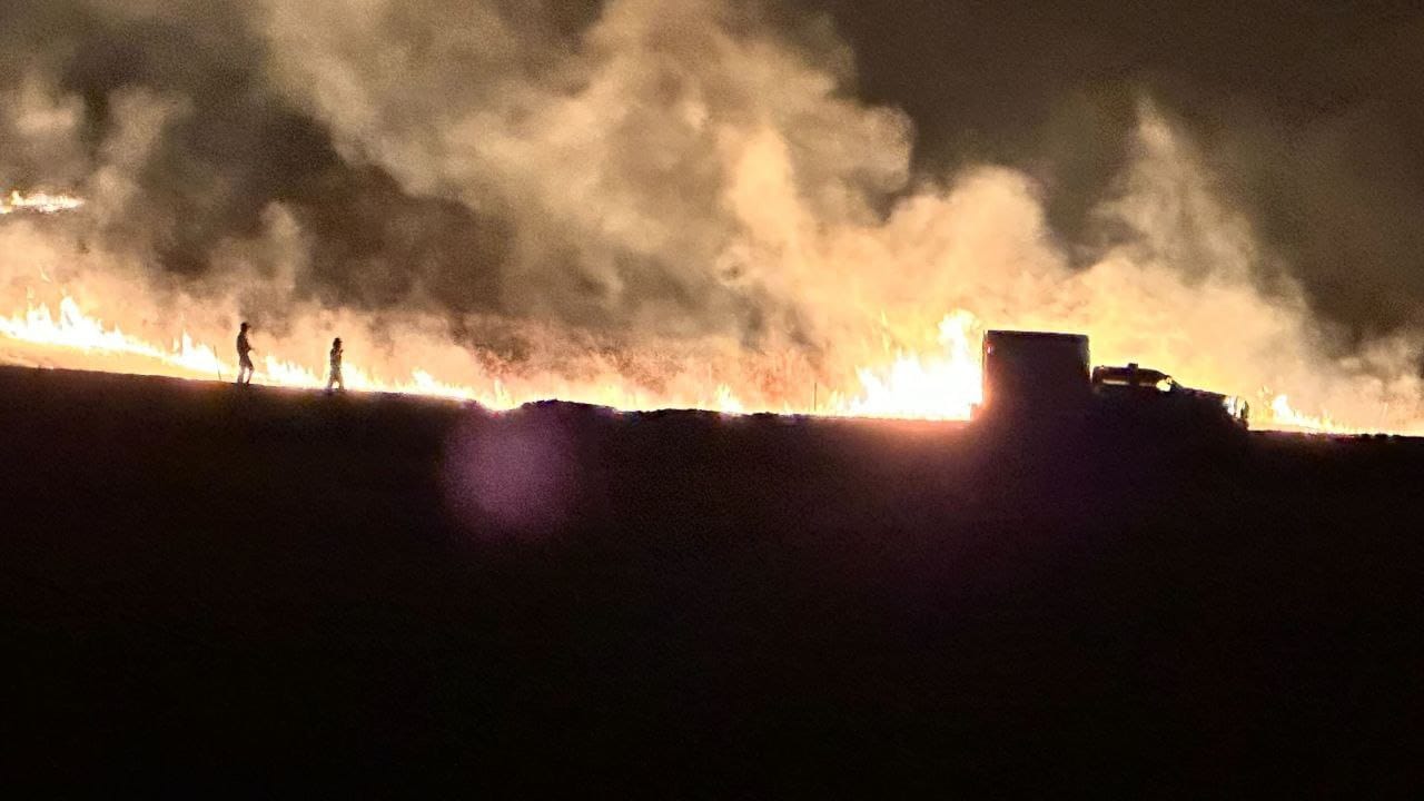
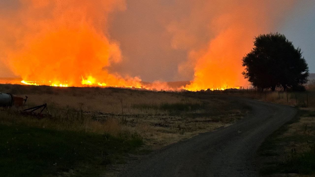
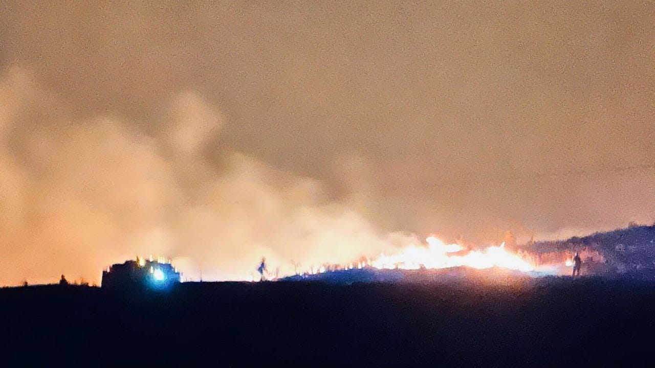
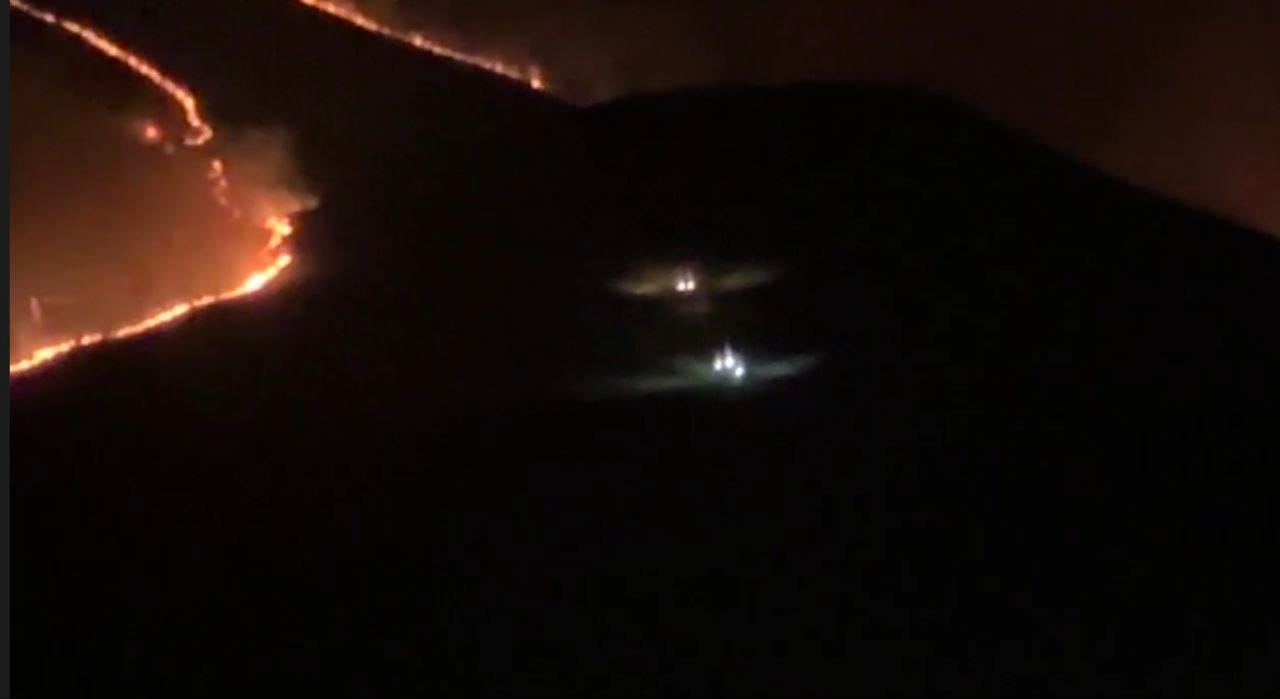
Paddock Fire Photos from the Night of 8/8 and pre-dawn 8/9. Sent to me by @flingerstakes
Wrap-up
A ton of progress has been made on the fire; it's still dangerous and has the opportunity for major growth, but I'm finding the work done in the last 2-3 days is paying off, and we're going to see more and more cold perimeter in the coming hours.
I'm aware of one home lost to the Paddock fire; our thoughts are with the family affected. As I understand it, one of the family members was a volunteer firefighter in the affected area who'd been working on the fire.
Okay, that's it for now, y'all. I may be back tomorrow evening if there are any major developments on any Idaho fires; otherwise, my next post will be late Sunday or Monday morning. Please do take a moment and reach out via social media or leave a comment below—it's nice just to know people are reading these and finding the content helpful. Thanks!
Member discussion