Monday's Outbreak
About this update
Today, we'll focus first on the status of the fire outbreak we've had since Monday's storms. I'll give you some numbers and make a few observations, then we'll look at a few notable fires. After that, we'll jump to (very brief) updates on the active large fire incidents: Limepoint, Boulder, Wolf Creek, Bulltrout, and Wapiti fires. I'll have a deeper look at these soon after the Initial Attack craziness wears off.
Keep in mind that this post was written late Tuesday night. I hope none of you are up reading it, so by the time you read this new information will be available on some of these fires early Wednesday. But I've already had to rewrite a few sections of this post since things are changing so fast. Just keep that in mind. I will likely do a on post on Wednesday night with any major developments.
Alright, let's jump in...
Outbreak...
Monday storms spark 75 fires
Context
Thunderstorms that moved across much of Idaho Monday brought high winds, small hail, tons of lightning, and, as is so often the case in Idaho, not nearly enough rain. Some areas did receive wetting rain, but those areas were fairly isolated and surrounded by areas receiving dry lightning.
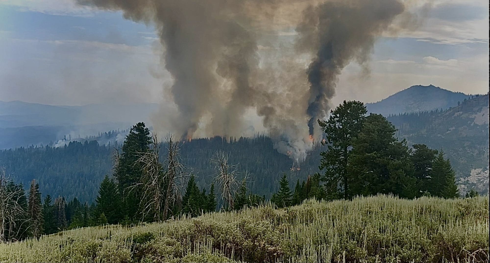
The storms don't seem to have much impact on existing large fire incidents, but the abundance of dry lightning gave us a classic Idaho summer fire outbreak. As a result, there have been 75 new fires in Idaho as a result of these fires. That number will continue to rise as new smokes will pop up for days after lightning – especially in the higher timber.
The Aftermath
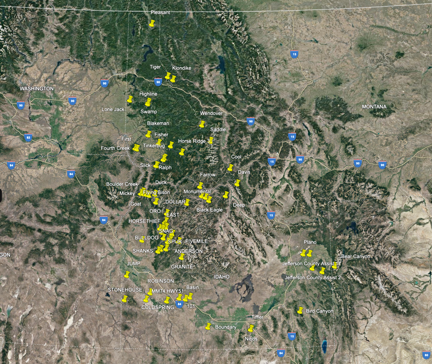
I created the above map of all the new fires that started in this outbreak. That's seventy-five new fires on that map. Fifty-seven of those new fires started between noon and midnight Monday as the storms passed through. We saw a mix of fire behavior; higher elevations saw light growth, while the SW Idaho highlands and rangelands across the state saw a lot of extreme fire behavior. I keep saying it, but I'll say it again – we're insanely lucky to see the light to moderate fire behavior we're (generally) seeing in the Central Idaho mountains. Aside from two specific days of the Bench Lake Fire near Redfish Lake, I don't think I've seen a single Central Idaho (or any other high-elevation forest) fire make a sustained run. It's bad, but we could be so much worse right now...
Initial Attack
As insane as Initial Attack (IA) was yesterday and today, we have to give major appreciation to the IA resources, dispatchers, and fire managers. Over sixty percent of the new fires have already been contained. Of the remaining 29 uncontained new fires, several are nearing containment, and many are unstaffed. These unstaffed fires are either burning in the wilderness (and thus may not be an active suppression fire) or the fires aren't active enough (or are no longer active enough) to justify dedicating IA resources. Long story short, IA crews are doing an amazing job.
Paddock Fire
20,000+ Acres
North of Emmett, ID, near Paddock and Crane Creek Reservoirs
Please heed all evacuation notices.
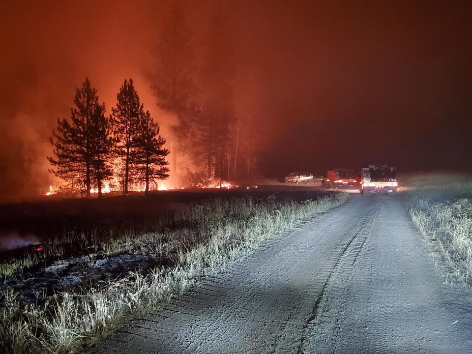
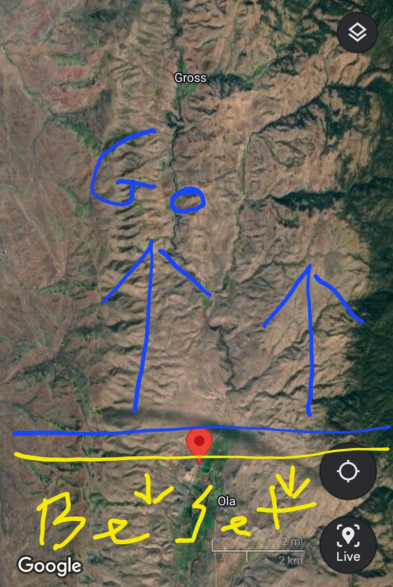
Sigh. At some point, I just have to commit to throwing out what I have on this fire. Please know that this is a dangerous fire. There are evacuation orders in place, and while I ALWAYS beg you to heed evacuation orders. I really, double-dog-dare you to heed evacuation warnings on this one. Also, if this fire manages to cross Chief Eagle Eye Creek around Ola, things are going to get extra dynamic, extra fast. Please pay attention to it.
For reference, here's the official evacuation map. No seriously, this is not mine. Although long-time followers of my fire content will recognize that whoever this person is went to the Zeb Palmer School of Map Making. Seriously though, this area is in extreme danger as I write this, please evacuate. And, just to be clear, I'm not making fun of their official evac map because it's clear and concise; I've seen far more confusing maps made by professionals.
And here's a look at the latest fire detections from recent MODIS & VIIRS Satellite passes.
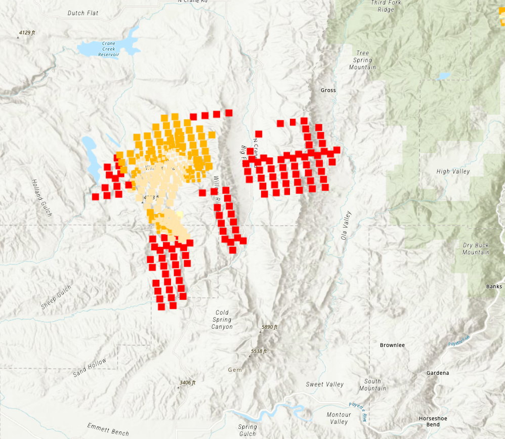
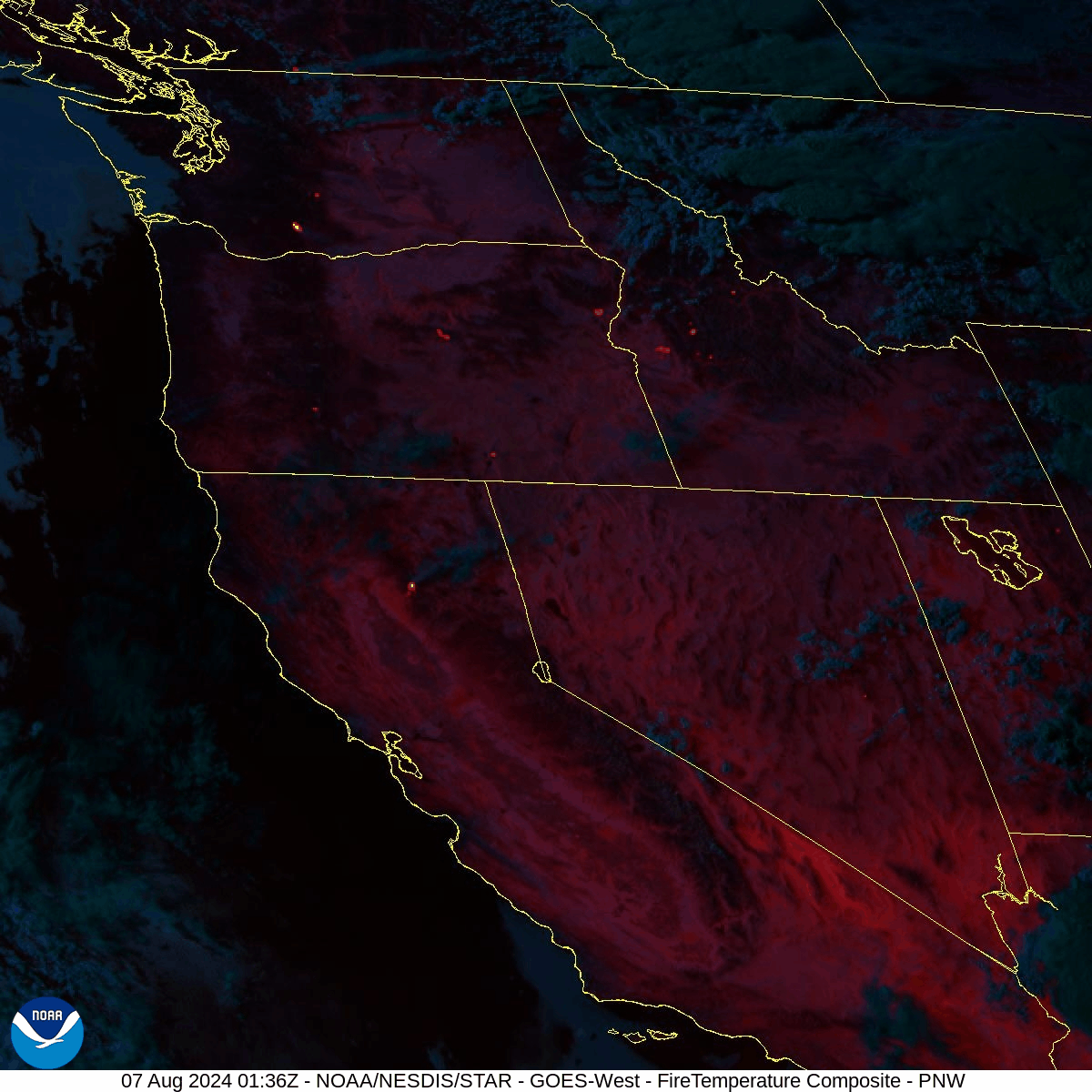
The Paddock Fire has had two days of very heavy Initial Attacks with a near-constant air show today, and it's still made an aggressive run north toward Crane Creek Reservoir and now a night run east toward Ola. This fire is burning in flashy fuels (grasses and low sage). The last official estimate is 20,000 acres. But that was before this current run, and what I'm seeing on the last MODIS/VIIRS Satelite pass would put that number much higher. My current estimate (as of midnight) is high enough that I won't even tell you what my estimate is cause it's crazy. But, it's undeniable that the fire has made a significant run and it's currently threatening homes and ranches near Ola. You can see the fire flare up after dark on the GOES-West Satellite Fire Temp Animation loop below. It's the fire in SW Idaho that looks like it's three fires almost touching each other (different flanks of the fire, far enough apart they look separate from space).
Wednesday morning EDIT: The fire is officially at 60,000+ acres now (my estimate was 65,000) this confirms a 40,000+ acre nighttime run on an initial attack fire. 🤯
Few Idaho range fires are turned over to an Incident Management team, as they can usually be handled within 2-3 days by local fire crews with assistance from regional air resources where needed. Given the activity today and the evacuation notices in the area, I would not be surprised if this gets an order for an Incident Management Team. That said, I don't have enough ground truth information to say if this fire is catchable at Ola before crossing Chief Eagle Eye Creek. It may lose enough steam in the wee hours of the night that it doesn't reach it, or such that a firing operation and dozer work can secure that road north of Ola. Or... it could burn all night. This will be the first fire I look at Wednesday morning – I'll post updates on my Threads account as soon as I have anything concrete.
Jump Fire
20,000+ Acres (contained shortly before this post)
South of Marsing, near Jump Creek Falls
The Jump Creek fire burned somewhere between 20 and 30 thousand acres; I'm not sure we'll get an accurate final perimeter anytime soon as it's now contained and thus extremely low priority for an IR mapping overflight tonight. Regardless, this one started near HWY 95 between Marsing and ION Summit in the Jump Creek Canyon. It burned hot and fast, exploding to 12,000 acres within a couple of hours, then 20,000 by dark. I'm estimating this fire at well above the official estimate, but having driven the fire area tonight, I'm seeing quite bit of mosaic burning in the flash fuels and sage, so it may be closer to the last official estimate.
Oddly enough, this fire burned quickly west (like the 2015 Soda fire that is the header image of this website), it burned up ION and northwest toward Succor Creek State Natural Area in Oregon. I was out there tonight, and as best I can tell, the fire did reach the Succor Creek Canyon near the campground, but I don't think it burned much in the canyon, and I suspect the trees in the campground are fine. At least, I hope so cause I like that canyon, and those trees make for nice shade as you stretch your legs.
Anyway, as noted above, this fire is officially contained as of the end of the day Tuesday. Great job by IA resources catching this one.
Other notable new fires
Bulldog: 300 acres – burning north of Crouch.
Soldier Creek (Oregon): 10428 acres – ok, yeah, this is an Oregon fire and the name of this site is "Idaho" Fire – but it's right on the border just south of Jordan Valley, OR. It could very well burn into Idaho at the Juniper Mountain which dances along the ID-OR border for several miles here. I don't think it will burn into Idaho, but it's a rock-throwing distance from it, so here it is. It had a significant air show Tuesday, and I'm not seeing as much heat; I suspect the Juniper Mountain road (Idaho Border) will be a successful control point stopping eastward growth should it get that far.
Basin: 6094 acres—Burning (very) near Glenns Ferry, on the south side of the river. It was at 40% contained as of 6 p.m. Tuesday, with an expected containment at the end of the day. That being said, I don't see that they actually logged it contained yet. Regardless, I don't see any further threat from this one.

Snag: 400 Acres—East of Cascade off the Warm Lake Road at Ora Mountain above Horsethief Res. It appears to be merged with the smaller Oro Fire. It is not currently a threat, but we need to keep an eye on it over the next few days.
Dollar Fire: 200 Acres—Near Needles east of Donnelly. It is not currently a threat and is not likely to be a threat within the next few days. The closest at-risk areas are Penny Spring Campground and Warm Lake.
Existing Large Fires
Limepoint, Wolf Creek, Boulder, Wapiti, Bulltrout
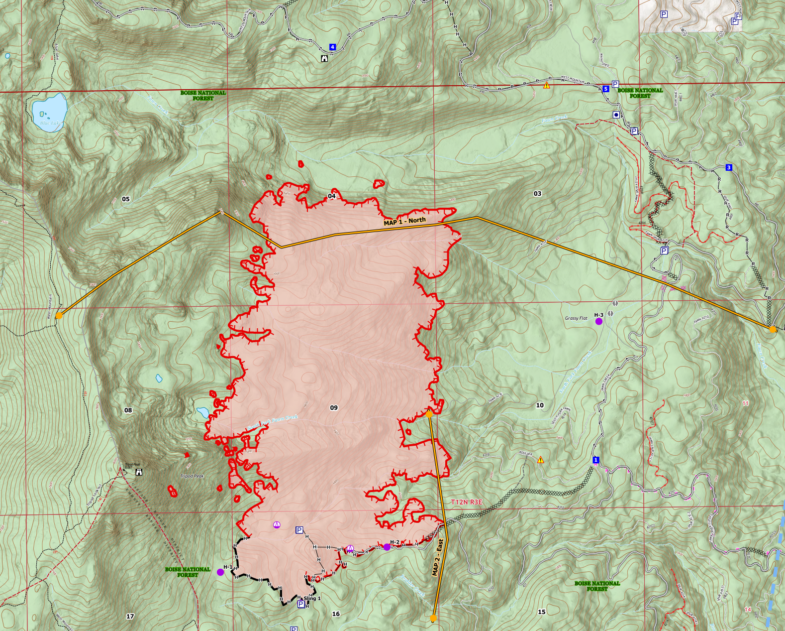
Limepoint Fire
23,805 acres
Near Cuprum & Hells Canyon
I really like what I'm seeing on this fire. Don't get me wrong, it's a big incident and a lot of work to be done, but I'm very optimistic that the threat to Cuprum, Bear, Wildhorse, and Barber Flats is being mitigated. It looks like they're really starting to pin this fire in, except for the north flank of the fire, which is a lower priority as it's not threatening homes. As that north flank burns NE it moves into areas with natural anchor points and I think they'll be able to make good progress on it soon.
Current Efforts:
- Southeastern Flank: Crews completed firelines around Wildhorse Canyon and improved lines in Flat Creek Canyon. A tactical firing operation was conducted south of Elk Creek.
- Eastern Flank: Hotshot crews finished handlines to Boulder Creek and conducted controlled burns. Mop-up operations are ongoing along Forest Road 071 and between Indian Creek and Huntley Gulch.
- Northern Flank: The fire is advancing into Kinney Creek, remaining half a mile from Horse Mountain Lookout. Crews are working to establish firelines up to the lookout.
- Southwestern and Western Flanks: Minimal activity was reported.
Wolf Creek
1,146 Acres – 14% Contained
Near Tamarack Ski Area
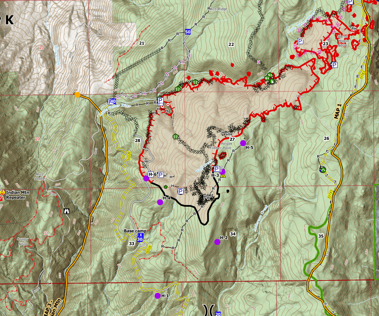
In my last newsletter, I mentioned that I thought the Wolf Creek Fire had jumped lines that were mapped as being "contained." It, in fact, did as shown by this animation I made. That map in the animation is now three days out of date, but it's been sitting in my draft folder, so I thought I'd share. Here's the latest Ops map for the fire.
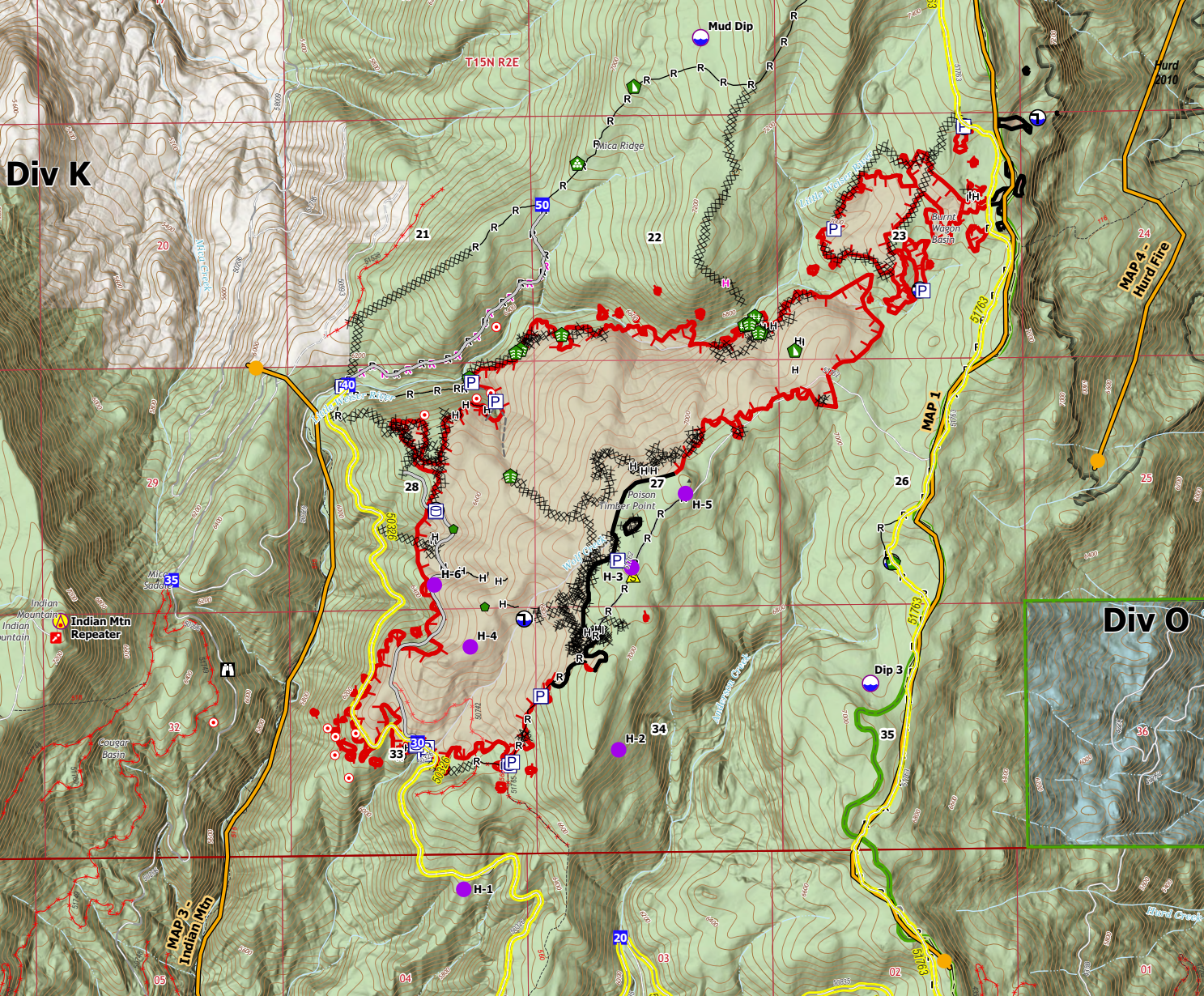
This fire shows low-moderate activity, and I'm not seeing much heat. Looking at Tuesday night's IR mapping mission, the map shows very little and very isolated heat signatures, with the analyst's notes confirming that:
"There was no heat perimeter growth, no intense or scattered heat and only scattered interior isolated heat." - Wolf Creek Fire IR Interpreter
The main concern is growth toward the northeast, and from watching it the last day or so and looking at the ops map, IR map, and all that, it looks like they've got that threat fairly well mitigated. Any fire movement on the east side of the ridge threatens residents along the lake and up towards Tamarack. They've fully contained the previous spot fires on the east side. I'm also seeing some good contingency work on Mica Ridge.
Fire movement east is still a threat, and we need to monitor this, but I'm really happy with what I'm seeing now.
Boulder
1023 Acres
Near Cascade
This fire continues a slow march north into Fawn Creek. The team will start 24/7 operations, and a heavy equipment task force (HETF) is working the fire, assisting with primary and contingency lines around it.
The south end of the fire has a direct fireline that is showing contained in some areas and likely approaching containment in others. The East and North sides of the fire have indirect lines using heavy equipment and existing roads to create fuel breaks. Some old-timers (and one specific Type 1 Incident Commander in particular) would tell you this is old-school "Salmon River Tactics," which boils down to counting two ridges over and building a "big-ass dozer line." For a long time, since ye olden days, building dozer lines was taboo; sure you'd see it occasionally, but stuff like this was much less common. It's come back in our region in the last decade, and we have access to great HETF resources. I'm fairly confident this fire won't escape the lines drawn–or at least as confident as one can be on an active fire. It'd take a significant wind event and some bad luck – which, I mean is possible, but I'm feeling pretty good about the Boulder Fire.
Wapiti
740 Acres
Near Grandjean (evacuations/closures in effect)
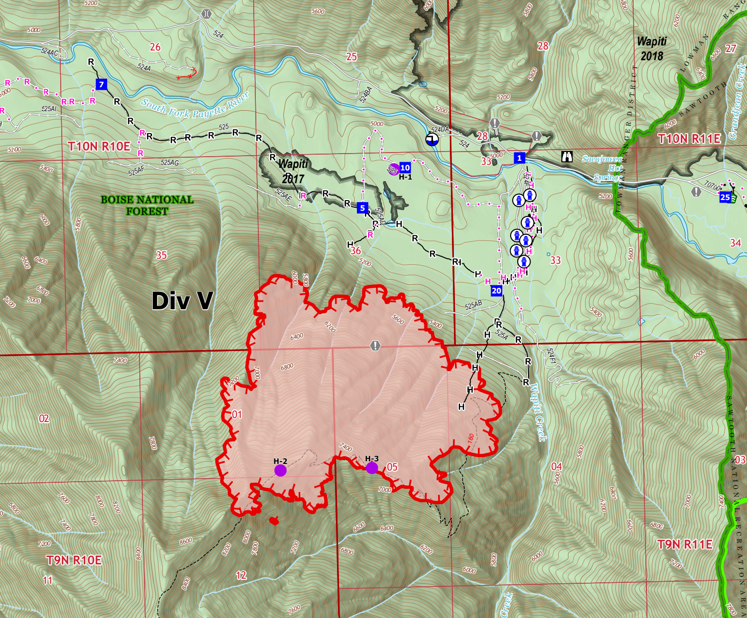
We've seen a lot more heat on this fire the last couple of days, and some growth Tuesday. The Tuesday night IR mapping mission shows lots of scattered and intense heat. Most of the work in the area has been point protection for the structures in Grandjean. From what I'm seeing, there's not been much if any, direct attack on this fire aside from bucket work by helicopters. This is a tough fire to fight, though, given the terrain. I'll dig into this one more in the next couple of days as a suppression plan develops and fire moves off of the one ridge it's been h0lding on.
Bulltrout
271 Acres
HWY 21 Banner Summit / Bull Trout Late
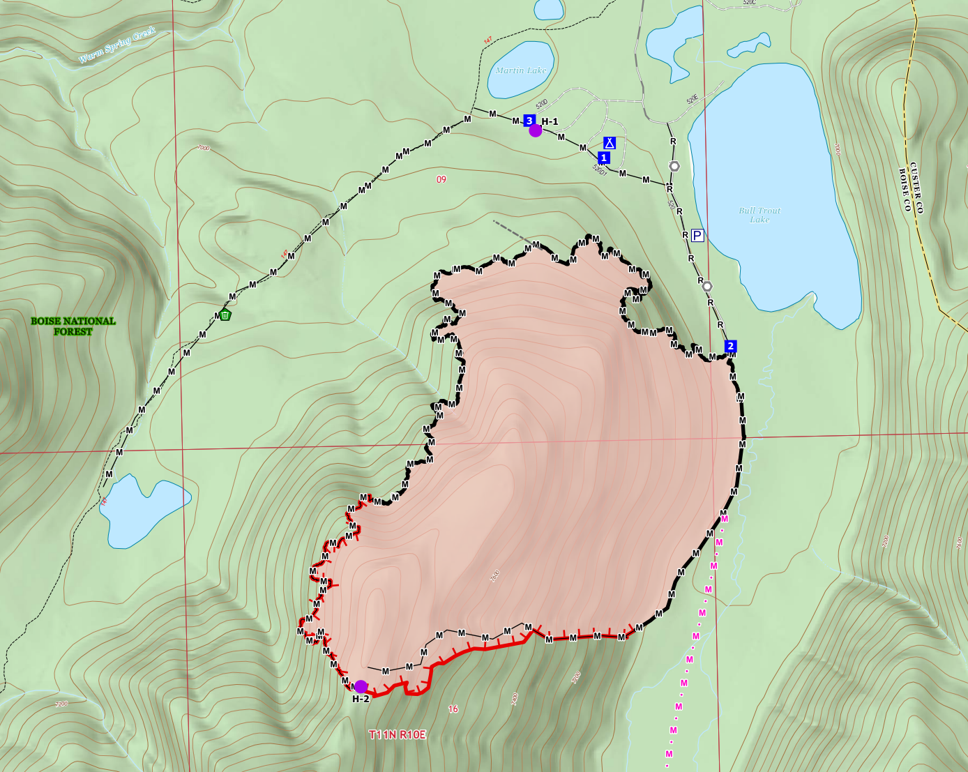
This is my last look at this fire unless something significant changes. They've got the fire pretty well lined and are working on mop-up. It will probably be a couple more days before we see full containment, but I'm no longer concerned with this fire.
Wrap-up
Okay, y'all. I think that's it. OMG, what a long one and a long two days watching fires. Keep in mind that covering Initial Attack fires is hard, as information and data are limited, and situations change rapidly. I try to keep up with everything and report as accurately as possible, but as you've undoubtedly gathered, it's been crazy the last few days. If you're in an affected area, please stay safe and heed all evacuation notices.
Thanks again for being here. Let me know if you have any comments, questions, concerns, etc.
Member discussion